![]() Le Blue Lagoon est à nouveau ouvert au public depuis ce 6 avril 2024 à midi, même si les autorités préviennent que la situation actuelle est toujours susceptible d’être menacée par les coulées de lave et la pollution par les gaz en provenance de Svartsengi. A noter toutefois que le Blue Lagoon est désormais équipé de capteurs de gaz et d’une station météo.
Le Blue Lagoon est à nouveau ouvert au public depuis ce 6 avril 2024 à midi, même si les autorités préviennent que la situation actuelle est toujours susceptible d’être menacée par les coulées de lave et la pollution par les gaz en provenance de Svartsengi. A noter toutefois que le Blue Lagoon est désormais équipé de capteurs de gaz et d’une station météo.
Il convient de noter que les visiteurs du Blue Lagoon, ainsi que toutes les autres personnes, à l’exception du personnel de secours, des scientifiques, des journalistes et des employés de la centrale de Svartsengi, ne sont pas autorisés à accéder au site de l’éruption depuis le parking du Blue Lagoon ou la Grindavíkurvegur. En effet, des concentrations élevées de SO2 ont été mesurés sur le site éruptif. Cette pollution est considérée comme très malsaine, avec un risque pour le système respiratoire.
Source ; Iceland Monitor.
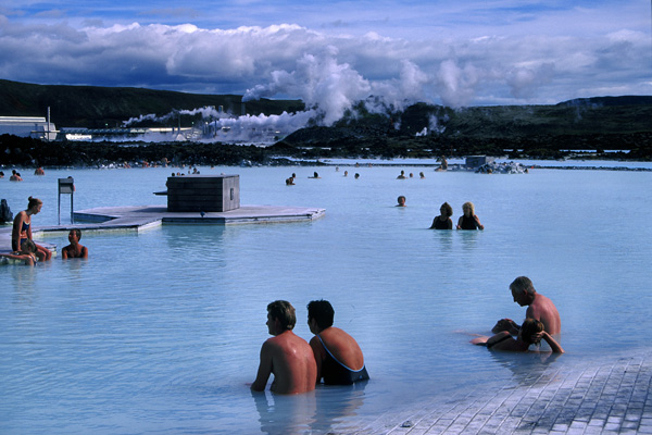
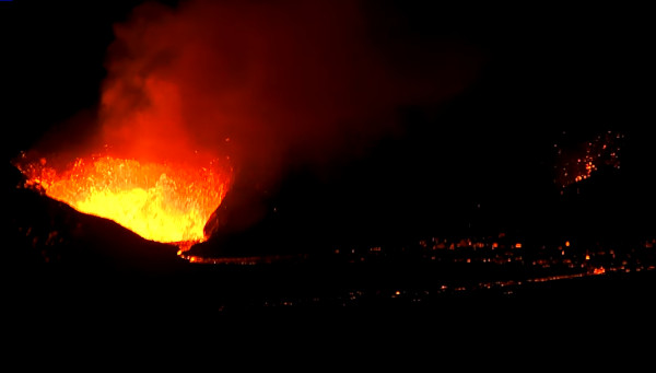
Photo: C. Grandpey
——————————————————-
![]() The Blue Lagoon opened again to the public today April 6th, 2024 at noon, even though local authorities warn that the current situation could be threatened by lava flow and gas pollution at Svartsengi. However, the Blue Lagoon is now equipped with gas meters. In addition, a weather station has been set up on the site.
The Blue Lagoon opened again to the public today April 6th, 2024 at noon, even though local authorities warn that the current situation could be threatened by lava flow and gas pollution at Svartsengi. However, the Blue Lagoon is now equipped with gas meters. In addition, a weather station has been set up on the site.
It should be noted that visitors to the Blue Lagoon, as well as all others excluding rescue personnel, earth scientists, journalists, and those working inside Svartsengi, are not allowed to access the eruption site from the parking lot of the Blue Lagoon or Grindavíkurvegur road. High levels of SO2 have been measured on the eruptive site. This pollution is considered very unhealthy and most people are likely to experience symptoms in the respiratory system.
Source ; Iceland Monitor.