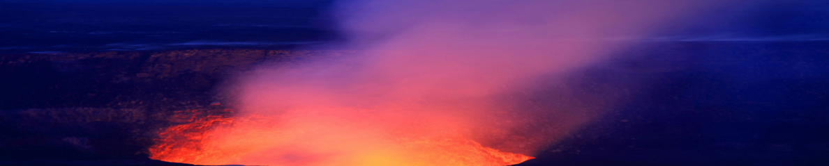
 L’Institut Géophysique équatorien indique que le Tungurahua a émis mercredi un panache de 7 km de hauteur, avec des retombées de cendre dans les villes autour du volcan.
L’éruption a débuté à 6h12 (heure locale) et « le bruit de l’éruption a été perçu dans les villes autour du volcan, y compris Baños et Guadalupe, à 14 km de distance ».
Le nuage s’est dirigé vers le SW et une forte pluie de cendre a été observée à 6h31 dans les villes de Mapayacu et Manzano. Une heure et demie plus tard, c’était au tour de Guano et Riobamba d’être arrosées.
Le Tungurahua a aussi émis de petites coulées de lave vers le N, NO, O et SO du cratère. Elles sont descendues sur des distances de 800 à 1000 mètres, sans toutefois menacer les zones habitées.
Selon l’Institut Géophysique, un nombre croissant de séismes a été enregistré le 17 mai. « Toutefois, si l’on se réfère au comportement historique du volcan, l’activité actuelle est faible, mais en hausse ».
 The Ecuadorian Geophysical Institute indicates that the volcano spewed a 7-km-high ash plume on Wednesday, spreading the ash cloud in some towns near the volcano.
The eruption occurred at 6:12 a.m. local time, and « the sound of the eruption was heard in the towns near the volcano, even in Banos and Guadalupe, 14 km away ».
The ash cloud traveled SW and thick ash fell at 06:31 a.m. in the towns of Mapayacu and Manzano. One and a half hours later the ash also fell over Guano and Riobamba.
Tungurahua also spewed small flows of lava at the north, northwest, west and southwest of its crater, which went down between 800 and 1,000 meters without affecting the inhabited areas.
According to the IG, an increasing number of earthquakes were registered on May 17th. « However, according to the historical behavior of the volcano, the current activity is considered low, but with increasing trend. »
