L’Office météorologique islandais a publié sur son site un article très intéressant sur les crues glaciaires qui sont très fréquentes en Islande en raison de l’impact de l’activité volcanique sur les glaciers. L’article explique au public à quel point ces événements peuvent être dangereux et quelles mesures de prévention ont été mises en place pour protéger la population. Ces crues glaciaires ont notamment été observées lors de l’éruption de l’Eyjafjallajökull en 2010.
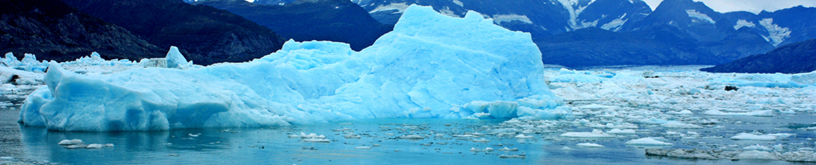
Les jökulhlaups (terme islandais pour désigner les crues glaciaires) sont plus fréquents en Islande qu’ailleurs dans le monde en raison de l’interaction des volcans avec les glaciers.
Les plus grands jökulhlaups issus du volcan sous-glaciaire Katla font partie des plus grandes crues que l’homme ait jamais observées. À leur maximum, le débit peut être plus important que celui de l’Amazone.
Les Islandais ont appris à éviter les plaines sur lesquelles débordent les jökulhlaups les plus fréquents, comme la Mýrdalssandur et la Skeiðarársandur, mais les plaines de débordement de la rivière Markarfljót, dans le sud de l’Islande, et de la rivière Jökulsá á Fjöllum, dans le nord de l’Islande, sont potentiellement exposées et les jökulhlaups inondent de temps à autre des parties de terres agricoles dans ces zones.
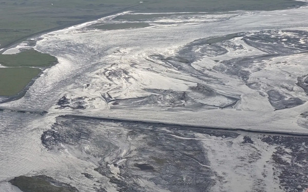
jökulhlaup dans les ‘sandur’ – ou plaines littorales – du sud de l’Islande (Crédit photo : Protection Civile)
Un système d’alerte est géré par l’Office météorologique islandais qui informe les autorités de la Protection civile des inondations imminentes. Les hausses inhabituelles du niveau d’eau ou de la conductivité électrique des rivières au niveau des principales jauges déclenchent une alerte qui est ensuite évaluée par les scientifiques. Ainsi, les responsables de la Protection civile disposent de quelques heures pour avertir le public.
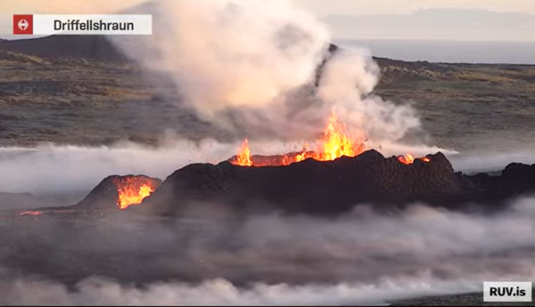
Le système a été mis à rude épreuve lors de l’éruption de l’Eyjafjallajökull le 14 avril 2010. Il n’y a guère que dans le secteur de l’Eyjafjallajökull et de l’Öræfajökull, dans le sud-est de l’Islande, que les inondations peuvent atteindre les zones habitées dans l’heure qui suit le début d’une éruption volcanique. Il est donc essentiel que les habitants réagissent rapidement aux alertes. Les jauges et les équipements du Met Office islandais ainsi que les vols de reconnaissance des garde-côtes ont joué un rôle clé pour informer la Protection civile et d’autres organismes du danger causé par les jökulhlaups au cours des premiers jours de l’éruption. En particulier au début de l’éruption, les crues charriaient des matériaux volcaniques ainsi que des icebergs et avançaient à une vitesse pouvant atteindre 20 km/h et l’eau était parfois chaude. Certains des jökulhlaups ont suivi le lit du glacier, tandis que d’autres se sont répandus à la surface du glacier jusqu’à sa bordure.
Les zones inondées ont été cartographiées pour chaque jökulhlaup. La propagation des fronts d’inondation a été observée avec précision, ce qui a fourni des données précieuses sur la nature de ces inondations si particulières.

Cette image montre deux jökulhlaups de l’Eyjafjallajökull en 2010 : l’un d’eux (en noir) s’est d’abord dirigé vers le nord puis le long du versant ouest de la montagne ; un autre, plus petit, est allé vers le sud
—————————————————-
 On its website, the Icelandic Meteorological Office has released a very interesting article about glacial outburst floods which are very frequent in Iceland because of the impact of volcanic activity on the glaciers. The article explains the public how dangerous these events can be and what prevention measures have been devised to protect the population. These glacial floods were particularly observed during the Eyjafjallajökull eruption in 2010.
Jökulhlaups (the Icelandic word for glacier outburst floods) are more common in Iceland than elsewhere in the world because of the interaction of volcanoes with glaciers. The greatest jökulhlaups from the subglacial Katla volcano are among the largest floods that humans have witnessed. At their maximum, the discharge may be larger than the average discharge of the River Amazon.
Icelanders have learned to avoid the outwash plains of the most frequent jökulhlaups, Mýrdalssandur and Skeiðarársandur, but the outwash plains of River Markarfljót, southern Iceland, and River Jökulsá á Fjöllum, northern Iceland, are potentially dangerous and jökulhlaups will sooner or later flood parts of the current farmlands in those areas.
A warning system is operated by the Icelandic Meteorological Office that informs Civil Protection Authorities of impending floods. Unusual increases in water level or electric conductivity at key water level gauges triggers a warning that is subsequently evaluated by scientists. Thus, Civil Protection Authorities may get a few hours’ head start in preventing public hazard.
An important test was put to the system in the advent of the Eyjafjallajökull volcanic eruption on 14 April 2010. Only at this volcano and Öræfajökull volcano, southeastern Iceland, are floods expected to reach inhabited areas within an hour from the start of a volcanic eruption. Therefore, a quick response to warnings is essential. The gauges and equipment of the Icelandic Meteorological Office as well as the reconnaissance flights of the Icelandic Coast Guard played a key role in the response of Civil Protection Authorities and other officials to the hazard caused by jökulhlaups during the first days of the eruption. Particularly in the beginning of the eruption, the jökulhlaups were charged with volcanic debris as well as icebergs and advanced at a very high velocity (up to 20 km/h) and some were hot. Some of the jökulhlaups found their way along the bed of the glacier but others flowed over the surface of the glacier all the way to the ice margin.
The flooded areas were mapped for each jökulhlaup. The propagation of the flood fronts was observed, sometimes providing valuable data on the nature of these extraordinary floods.