
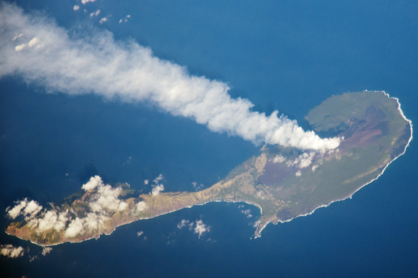
 Ce n’est pas souvent que l’on peut voir l’Ile Pagan. Cette photo a été prise le 6 mars 2012 par l’un des astronautes à bord de l’ISS qui se trouvait alors à environ 480 km au SSO. On peut voir le volcan actif dans la partie nord de l’île qui présente deux volcans séparés par un isthme. L’activité confirme le dernier bulletin du GVN qui faisait état d’ »un panache de gaz et de vapeur qui s’étirait sur 204 km en direction du SSO ».
L’archipel des Mariannes marque la limite tectonique entre la vieille plaque Pacifique qui plonge sous la Mer des Philippines. C’est dans la fosse des Mariannes que se trouve la plus grande profondeur océanique de la planète (plus de 10 000 mètres).
Vous obtiendrez une photo avec une meilleure résolution en cliquant sur ce lien :
http://eoimages.gsfc.nasa.gov/images/imagerecords/77000/77503/ISS030_E_122047_lrg.jpg
 Here is a rare view of Pagan Island seen from the ISS on March 6th 2012. One can see the active volcano in the northernmost part of the island which includes two volcanoes separated by an isthmus. Activity corresponds with the GVN’s latest report indicating « a gas-and-steam plume, with possible ash content, drifting 204 km SSW. » The ISS was located over the Pacific Ocean approximately 480 kilometres to the southeast of Pagan Island when the image was taken
The Mariana Islands mark the tectonic boundary where the Pacific plate is being subducted at the Marianas trench beneath the younger, less dense crust of the Philippine Sea. The Marianas Trench includes the deepest spot in the Earth’s oceans (more than 10,000 meters).
You will see a higher resolution image of Pagan by clicking on this link:
http://eoimages.gsfc.nasa.gov/images/imagerecords/77000/77503/ISS030_E_122047_lrg.jpg

 Au retour d’une campagne en Antarctique, le navire de recherche océanographique « Las Palmas » a réalisé le jeudi 12 avril 2012 des relevés bathymétriques au large de la côte de la Restinga afin de mettre à jour les données concernant l’éruption sous-marine.
 Back from a mission in Antarctica, the research ship « La Palmas » performed on Thursaday April 12th 2012 bathymetric measurements off La Restinga in order to update the data about the current submarine eruption.