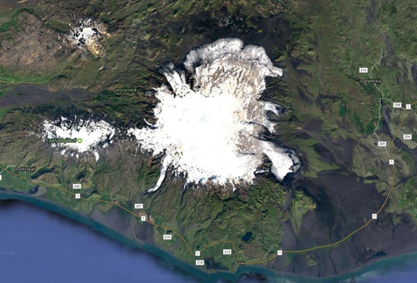
Façonnée par des éruptions qui ont eu lieu de 1963 à 1967, Surtsey, à environ 32 km au sud de la côte islandaise, est une île volcanique qui fait partie du Patrimoine Mondial de l’UNESCO qui la définit en ces termes : « Protégée dès sa naissance, elle fournit au monde un laboratoire naturel tout à fait remarquable. Libre de toute interférence humaine, Surtsey est une source unique et continue d’informations sur la colonisation d’une nouvelle terre par la vie végétale et animale ». Les oiseaux, les insectes et les phoques ont trouvé refuge sur Surtsey et des organismes étranges se sont installés sur les roches qui forment l’île. La chaleur du sous-sol a transformé les dépôts de téphra en tuf qui peut mieux résister aux assauts de l’océan.
Au vu de la définition de l’UNESCO, je pensais que Surtsey serait protégé contre toute ingérence humaine. C’était vrai … jusqu’à maintenant.
On peut lire sur le site Internet Iceland Review que « le plus grand projet de recherche sur l’île Surtsey depuis sa naissance en 1963-1967 débutera en août ». Les scientifiques vont procéder à des forages sur l’île et recueillir des échantillons et des données qui seront ensuite utilisés pour plusieurs projets différents. Le projet de recherche initial sera dirigé par un professeur de géophysique à l’Université d’Islande, en collaboration avec un autre professeur de l’Université de l’Utah et un groupe de scientifiques internationaux.
Le titre du projet est SUSTAIN et son objectif est de regrouper de nombreux domaines de recherche pour montrer comment s’est formée une île volcanique.
Le but est de prélever deux carottes, l’une issue d’un forage vertical de 200 mètres et une autre à partir d’un trou angulé de 300 mètres. Selon le projet, « l’apparition et l’évolution de la chaleur géothermale seront étudiées an tant qu’exemple d’un système géothermal de courte durée dans la zone de rift d’une croûte océanique ». Les micro-organismes et leur rôle sur l’île seront également étudiés et le trou de forage vertical sera utilisé pendant les décennies à venir pour effectuer d’autres recherches.
Tout cela signifie que Surtsey ne sera plus une terre intacte et bien protégée. On peut se demander si un tel projet vaut vraiment la peine. Est-ce que cela apportera plus d’informations qu’un forage similaire sur la grande île d’Islande?
——————————————
 Formed by volcanic eruptions that took place from 1963 to 1967, Surtsey, approximately 32 km from the south coast of Iceland, is a volcanic island on the list of UNESCO’s World Heritage which defines it in these words: “ It is all the more outstanding for having been protected since its birth, providing the world with a pristine natural laboratory. Free from human interference, Surtsey has been producing unique long-term information on the colonisation process of new land by plant and animal life”. Birds, insects and seals have found their homes on Surtsey and strange organisms have settled down in the rocks that form the island. Geothermal heat has changed the loose tephra into tuff that can better withstand the surrounding ocean.
Reading UNESCO’s definition, I thought that Surtsey would be protected from any human interference. It was… up to now.
One can read on the website Iceland Review that “the biggest research project on the volcanic island of Surtsey since its creation will begin this August”. Scientists will be drilling holes in the island and gathering samples and data that will then be used for multiple different projects. The initial research project will be led by a Professor of Geophysics at the University of Iceland, along with another professor of the University of Utah and a group of international scientists.
The project title is SUSTAIN and its goal is to bring together many different fields of studies to show how a volcanic island is formed,
The plan is to take two drill cores, a 200-metre vertical core and a core from a 300-metre angled hole. According to the project, “the inner build and evolution of geothermal heat on the island will be researched as an example of a short-lived geothermal system in a rift zone of a oceanic crust.” Microorganisms and their role on the island will also be researched and the vertical drill hole will be used for decades to come for further investigations.
All this means that Surtsey will no longer be an unspoilt land and we may wonder whether such a project is really worth while. Will it bring more information than a similar drilling on Iceland’s main island?

Source: Iceland Review

 Le niveau d’alerte du Katla vient de repasser au Vert, après avoir momentanément été élevé à la couleur Jaune. Cela signifie que l’activité volcanique a décliné et que rien ne laisse entrevoir une éruption dans le court terme. D’autre part, la crue glaciaire de la rivière Múlakvísl est maintenant terminée.
 Katla’s alert level has been moved from Yellow back to Green. This means that volcanic activity has subsided and that there are no signs of an impending eruption. The glacial river flood at Múlakvísl is also over.