La fonte du permafrost libérerait du protoxyde d’azote // It is feared the melting of permafrost may release nitrous oxide

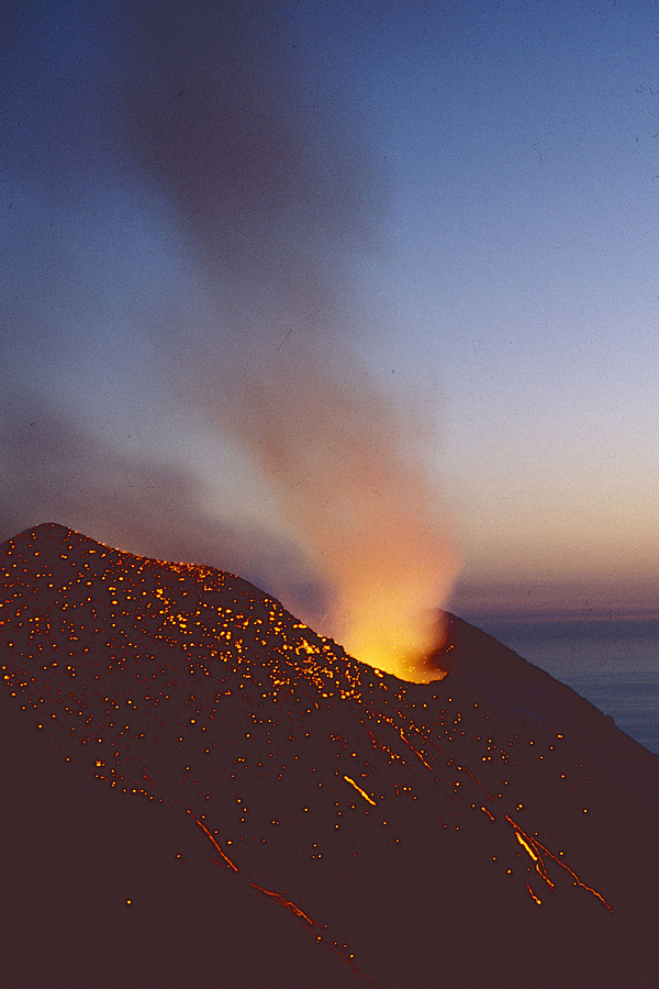
Selon le site web de la chaîne d’information France Info, une quantité toujours plus importante de protoxyde d’azote – un gaz hilarant – risque d’être relâchée dans l’atmosphère de l’Arctique sous l’effet du réchauffement climatique. C’est ce que révèle une étude parue dans les Proceedings of the National Academy of Sciences . Ce protoxyde d’azote (N20) est enfermé dans le permafrost qui est en train de fondre à une vitesse impressionnante dans cette région du monde

Les chercheurs ont réalisé seize prélèvements de pergélisol en Laponie finlandaise, qu’ils ont congelés puis réchauffés. Selon leurs travaux, les émissions de protoxyde d’azote sont d’autant plus probables que la surface de la tourbe est vierge en végétation. En effet, les plantes absorbent l’azote du sol et réduisent le stock disponible pour la production de protoxyde d’azote. Les plantes sont donc très efficaces pour réduire les émissions de protoxyde d’azote.

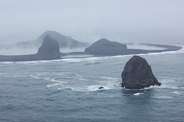
Selon les auteurs de l’étude, les régions à forte probabilité d’émission de N2O couvrent un quart de l’Arctique. Ils ajoutent que ce gaz possède un pouvoir de réchauffement 300 fois plus important à celui du dioxyde de carbone. Pour l’heure, ce gaz n’est pas pris en compte dans les modèles des climatologues, car les quantités d’émission sont jugées négligeables, contrairement au méthane, qui inquiète beaucoup les scientifiques. Toutefois, le dégel croissant du permafrost pourrait changer la donne.

Un autre chercheur précise que cette étude ne peut livrer que des informations partielles à la compréhension du phénomène car les échantillons de pergélisol ont été congelés et réchauffés en laboratoire. Il existe donc une incertitude en raison des différences selon les spécificités du terrain, notamment l’étendue des tourbières.

De mon point de vue, cette émission de protoxyde d’azote ne viendra pas bouleverser la situation car elle est probablement minime est n’est pas généralisée. De toute façon, elle ne devrait pas avoir de conséquence pour la population locale qui est très disséminée. Les gaz les plus préoccupants sont le CO2 et surtout le méthane dont on connaît les effets extrêmement négatifs.

S’il y a quelqu’un que le protoxyde d’azote laisse indifférent, c’est bien le président des Etats-Unis qui vient d’annoncer que son pays sort de l’Accord de Paris sur le climat. La raison est que l’accord est mauvais pour les Etats-Unis et nuit à l’économie du pays. Une fois encore, on apprécie l’intelligence du personnage. La décision de Donald Trump sera approuvée par un grand nombre d’Américains qui ont été conditionnés à l’idée que le réchauffement climatique appartient à un cycle naturel et n’a rien à voir avec leurs activités industrielles. J’ai encore pu m’en rendre compte le mois dernier lors de discussions avec les personnes que j’ai rencontrées.

—————————————–

According to the website of the France Info news channel, an increasing amount of nitrous oxide – a laughing gas – is likely to be released into the atmosphere of the Arctic as a result of global warming. This was revealed by a study published in the Proceedings of the National Academy of Sciences. Nitrous oxide (N20) is enclosed in the permafrost which is melting at an impressive speed in this region of the world
The researchers carried out sixteen permafrost samples in Finnish Lapland, which they froze and then heated. According to their work, emissions of nitrous oxide are all the more likely as the surface of the peat is devoid of vegetation. In fact, plants absorb nitrogen from the soil and reduce the stock available for the production of nitrous oxide. Plants are therefore very effective in reducing emissions of nitrous oxide.
According to the authors of the study, regions with a high probability of N2O emissions cover a quarter of the Arctic. They add that this gas has a heating capacity 300 times greater than that of carbon dioxide. For the time being, this gas is not taken into account in climate models, because the emission quantities are considered negligible, unlike methane, which worries scientists a lot. However, the increasing melting of permafrost could change the situation.
Another researcher says that this study can provide only partial information to understand the phenomenon because permafrost samples have been frozen and heated in a laboratory. There is therefore uncertainty due to differences with the characteristics on the field, particularly the extent of the peatlands.
From my point of view, this emission of nitrous oxide will not upset the situation because it is probably minimal and is not generalized. In any case, it should not have any consequences for the local population, which is very sparse. The gases of greatest concern are CO2 and especially methane whose effects are extremely negative.

The U.S. president is not preoccupied with the nitrous oxide emissions. He has just announced that his country would withdraw from the Paris climate Agreement. The reason is that the Agreement is bad for the United States and detrimental to its economy. Once again, one can admire the intelligence of this man. Donald Trump’s decision will be approved by a great number of Americans who have beeen conditioned to the idea that climate change belongs to a natural cycle and has nothing to do with their industrial activities. This was confirmed by talks with people I met in May during my journey across American West.

Modélisation 3D de la chambre magmatique du Stromboli // 3D model of Stromboli’s magma chamber

Les scientifiques de l’INGV (Istituto Nazionale di Geofisica e Vulcanologia) et du CNT (Centro Nazionale Terremoti) viennent de réaliser une modélisation 3D de la chambre magmatique du Stromboli, située entre 2 et 4 km de profondeur. Ils ont pu réaliser cette tâche grâce aux images acquise par technologie tomographique, semblable à celle utilisée dans les hôpitaux. Les résultats ont été publiés dans la revue Geophysical Research Letters.
Domenico Patane, chercheur à l’INGV explique que « le projet est né de la nécessité d’en savoir plus sur la structure interne du volcan.» Pour ce faire, les scientifiques ont installé 20 stations sismiques temporaires sur l’île, en plus du réseau de 13 stations permanentes, et ils l’ont complété par 10 sismomètres au fond de la mer (Ocean-Bottom Seismometers, OBS), ce qui a permis pour la première fois d’explorer la partie sous-marine du volcan.
« La surveillance géophysique et géochimique du Stromboli au cours des dernières années a été renforcée par l’INGV, surtout après la crise éruptive de 2002-2003, le tsunami du 30 décembre 2002 et le paroxysme du 5 avril 2003 ». Les recherches ont intégré les données acquises en 2006 à bord du navire de recherche Urania du CNR (Consiglio Nazionale delle Ricerche), en même temps que des enregistrements d’événements sismiques locaux effectués par le réseau permanent.
« Il a été possible de définir pour la première fois la géométrie de la chambre magmatique superficielle du Stromboli, qui s’étend depuis l’île proprement dite jusqu’au Strombolicchio. Ce dernier représente la cheminée centrale de l’ancien volcan, émergé il y a environ 200 000 ans au nord-est de Stromboli et aujourd’hui presque totalement érodé. »
Les images tomographiques montrent deux régions présentant des anomalies, à différentes profondeurs, là où est stocké le magma qui alimente l’activité permanente du Stromboli. De plus, grâce aux images tomographiques de la croûte de surface, les scientifiques possèdent maintenant un modèle physique en 3D de la géométrie de la chambre magmatique, ce qui devrait contribuer à l’avenir à effectuer de meilleures prévisions des phénomènes volcaniques.

Source : ANSA.it.

—————————————–

Scientists from INGV (CNRS) and CNT (Centro Nazionale Terremoti) have just completed a 3D model of the magma chamber of Stromboli Volcano, located between 2 and 4 km deep. They were able to perform this task with images acquired by tomographic technology, similar to that used in hospitals. The results were published in the journal Geophysical Research Letters.
Domenico Patane, a researcher at INGV, explains that « the project was born of the need to know more about the internal structure of the volcano. » To do this, scientists installed 20 temporary seismic stations on the island, beside the network of 13 permanent stations, and completed it with 10 seismometers at the bottom of the sea (Ocean-Bottom Seismometers, OBS), allowing for the first time to explore the underwater part of the volcano.
« The geophysical and geochemical monitoring of Stromboli in recent years has been reinforced by INGV, especially after the eruptive crisis of 2002-2003, the tsunami of 30 December 2002 and the eruption of 5 April 2003 ». The research incorporated data acquired in 2006 on board the research vessel Urania of CNR (Consiglio Nazionale delle Ricerche), together with records of local seismic events carried out by the permanent network.
« It was possible to define for the first time the geometry of the shallow magma chamber of Stromboli, which extends from the island proper to Strombolicchio. The latter represents the central chimney of the ancient volcano, emerged some 200,000 years ago northeast of Stromboli and now almost totally eroded.  »
The tomographic images show two regions with anomalies at different depths, where the magma that supplies the permanent activity of Stromboli is stored. Moreover, thanks to the tomographic images of the surface crust, scientists now possess a 3D physical model of the geometry of the magmatic chamber, which should contribute in the future to better predictions of volcanic phenomena.
Source: ANSA.it.

Source: INGV / La Sicilia

Photo: C. Grandpey

Antelope Canyon (Arizona) : Mon cher canyon ! // Antelope, my dear canyon !

Pour qui visite l’ouest des Etats-Unis, Antelope Canyon figure inévitablement sur la liste des priorités. Situé dans le nord de l’Arizona, à côté de la petite ville de Page et du Lac Powell, dans la réserve de navajo, le site est constitué de deux gorges séparées, l’Upper Antelope Canyon et le Lower Antelope Canyon.

L’histoire dit que c’est une jeune indienne navajo, partie à la recherche d’un de ses moutons, qui découvrit cette gorge. L’Antelope Canyon peut seulement être visité en excursions guidées, officiellement parce que des pluies soudaines peuvent rapidement l’inonder (des Français y ont perdu la vie il y a quelques années), mais surtout parce que la visite représente une entrée d’argent considérables pour les Navajos.

Quand j’ai visité Antelope Canyon en 2002, le prix d’entrée était acceptable, le nombre de visiteurs raisonnable, et on pouvait prendre des photos librement en utilisant un trépied. Aujourd’hui, les choses ont bien changé. Internet a contribué à la popularité du site, les touristes se précipitent…et les prix grimpent. Il faut arriver assez longtemps à l’avance pour réserver sa place (on peut le faire aussi sur Internet). Il faut débourser 48 dollars par personne pour effectuer la visite entre 11 heures et 13 heures, au moment où le soleil est au zénith et où la lumière est la plus belle à l’intérieur du canyon. C’est un peu moins cher le reste du temps. Pas de problème, les Navajos ont le sens du commerce ! J’ai eu une bonne discussion avec mon guide à l’issue de la visite et je lui ai fait remarquer que les tarifs pour les tours photographiques (90 dollars) frisaient l’arnaque, ce qu’il n’a guère apprécié. Le Navajo est susceptible, semble-t-il….

C’est vrai que la visite d’Antelope Canyon à l’heure du déjeuner est somptueuse, avec des lumières (incidentes surtout) d’une grande beauté. S’agissant de la photo, la gamme de sensibilités offerte par les derniers reflex numériques permet de se passer d’un trépied qui était obligatoire à l’époque où seule existait la photo argentique.

S’agissant de la visite, on vous conduit en 4×4 en suivant le lit d’une ancienne rivière jusqu’à l’entrée du canyon. La visite suit  ce dernier sur environ un kilomètre, avec des explications fort intéressantes.

La partie la plus fréquentée est l’Upper Antelope Canyon, plus grande et d’un accès facile. Par contre, pour le Lower Antelope Canyon, plus petit, l’entrée dans la faille est plus sportive et s’effectue avec des escaliers métalliques mis en place par les Navajos. Les visiteurs sont donc moins nombreux. Les deux failles présentent une qualité esthétique similaire, même si je préfère personnellement l’Upper Antelope Canyon.

—————————————-

For those visiting western United States, Antelope Canyon is inevitably on the list of priorities. Located in northern Arizona, adjacent to the small town of Page and Powell Lake in the Navajo Reserve, the site consists of two separate gorges, the Upper Antelope Canyon and the Lower Antelope Canyon.
The story says that a young Indian Navajo, in search of one of her sheep, discovered this slot canyon. Antelope Canyon can only be visited on guided excursions, officially because sudden rains can quickly flood it (French people lost their lives a few years ago), but mainly because the visit is a onsiderable source of money for the Navajos.
When I visited Antelope Canyon in 2002, the entrance fee was acceptable, the number of visitors reasonable, and you could take pictures freely using a tripod. Today things have changed. Internet has contributed to the popularity of the site, tourists are rushing … and prices are climbing. You need to arrive early to reserve your visit (you can also do it on the Internet). You have to pay $ 48 per person for a visit between 11 am and 1 pm, when the sun is at the zenith and the light is the most beautiful inside the canyon. It’s a bit cheaper the rest of the time. No problem, the Navajos have a sense of commerce! I had a good talk with my guide at the end of the visit and I pointed out to him that the rates for the photo tours (90 dollars per person) are close to a scam, which he did not appreciate. It looks as if the Navajo is touchy….
It is true that the visit of Antelope Canyon at lunch time is sumptuous, with lights (especially indirect lights) of great beauty. As for the photo, the range of ISOs offered by the latest digital cameras makes it possible to dispense with a tripod which was absolutely necessary at the time of analog photography.
As for the visit, you are driven in a 4×4 vehicle along the bed of an old river up to the entrance of the canyon. The visit goes along the canyon over about one kilometer, with very interesting explanations.
The most popular site is the Upper Antelope Canyon, larger whose access is easier. The Lower Antelope Canyon is, smaller and getting into it is more sporty, with metal ladders set up by the Navajos. Visitors are therefore less numerous. Both faults have a similar aesthetic quality, although I personally prefer the Upper Antelope Canyon.

Photos: C. Grandpey


Le Bogoslof, un casse-tête pour l’Alaska Volcano Observatory! // Bogoslof, a real headache for AVO researchers !

Le Bogoslof, actuellement le volcan le plus actif d’Alaska, sur une île perdue en Mer de Béring, est de nouveau entré en éruption au cours du week-end. Comme je l’ai précisé, l’événement a duré une cinquantaine de minutes, avec des éclairs volcaniques et un nuage de cendre qui est monté au moins à 10 500 mètres, ce qui a incité l’AVO à émettre une alerte Rouge qui a été abaissée à l’Orange par la suite.
Le Bogoslof occupe une petite partie de l’île du même nom à 60 milles nautiques (environ 110 km) à l’ouest de Dutch Harbor. D’un diamètre de moins d’un kilomètre, l’île est la partie émergée d’un volcan sous-marin beaucoup plus volumineux.
L’éruption de samedi a surpris tout le monde, comme c’est souvent le cas avec le Bogoslof. Le volcan connaît des épisodes éruptifs depuis le mois de décembre, avec une quarantaine d’événements enregistrés. Les scientifiques ne peuvent pas installer d’équipements de surveillance sur l’île qui est trop petite et le volcan trop actif. Comme l’a dit un volcanologue : « Si nous avions installé des instruments là-bas, ils auraient été détruits au moins à 40 reprises ».
En conséquence, les chercheurs doivent se fier aux instruments placés sur des volcans voisins pour détecter des variations sismiques annonçant une éruption imminente, mais la prévision n’est pas aussi précise que si les équipements étaient sur le Bogoslof proprement dit. Cela signifie que les scientifiques sont informés de l’éruption alors qu’elle a déjà démarré.
Compte tenu de l’imprévisibilité du volcan, tous les scientifiques, qu’il s’agisse de volcanologues ou de biologistes, ont annulé tout projet de visite du volcan en ce moment.  S’il entrait brutalement en éruption avec des chercheurs sur l’île, il n’y aurait nulle part où s’abriter.
Les éruptions passées ont érigé de nouvelles banquettes et des aiguilles de matériaux. En février, les éruptions ont triplé la taille de l’île. En mai, un nouveau lac d’eau chaude d’où s’échappait de la vapeur a été photographié lors d’un survol de la Garde côtière des États-Unis.
Pendant les deux premiers mois d’activité du Bogoslof, les explosions étaient très régulières; Elles se produisaient tous les deux jours. Puis, le volcan s’est calmé pendant environ deux mois, avant une éruption mineure à la mi-mai…

A noter qu’une nouvelle éruption d’une dizaine de minutes a été observée le 31 mai 2017. Sa brièveté n’a toutefois pas justifié la modification du niveau d’alerte.
Source: AVO & Alaska Dispatch News.

 —————————————–

Alaska’s most active volcano, the tiny Bogoslof on the remote island of the Bering Sea, erupted again over the weekend. As I put it before, the event lasted about 50 minutes, producing volcanic lightning and an ash cloud rising to at least 10,500 metres, prompting the AVO to issue a Red alert which has since been downgraded.

Bogoslof is a tiny sliver of an island that lies 60 nautical miles (about 110 km) west of Dutch Harbor. Less than a kilometre across, the island is the tip of a much larger underwater volcano.

Saturday’s eruption surprised everybody, as is usyally the case with Bogoslof: While the volcano has been in an active eruption cycle since December with some 40 volcanic events detected, scientists can’t put monitoring equipment directly on the island which is so small and the volcano so active that sensitive instruments researchers use to monitor volcanic activity can’t be placed there. Said one volcanologist: « If we’d had instruments out there, they probably would have been destroyed 40 times over by now. »

As a consequence, researchers must rely on instruments, placed on neighbouring volcanoes, that can detect seismic changes that herald an impending eruption but not nearly as precisely as if they were on Bogoslof itself. That means scientists know about the eruption as it’s already happening.

Given the unpredictability of the volcano, all scientists, whether they are volcanologists or biologists, have pretty much cancelled any plans to visit the volcano at the moment. If Bogoslof were to go off with researchers on the island, there would be nowhere to hide.

Past eruptions have carved new shelves and spires of land. As of February, the eruptions that started in December had tripled the island’s size. In May, a newly formed, steaming hot lake was captured by a U.S. Coast Guard flyover.

For the first two months, the explosions were very regular; they were happening once every one or two days. Then Bogoslof went quiet for about two months, until a smaller eruption that happened in mid-May.

It should be noted that a 10-minute eruption occurred on May 31st but its brevity did not justify a change of the alert level.

Source: AVO & Alaska Dispatch News.


Vues du Bogoslof le 8 mai 2017 (Crédit photo: AVO)