 Voici quelques informations pratiques à l’attention de ceux qui ont projeté de se rendre en Islande dans les prochains jours.
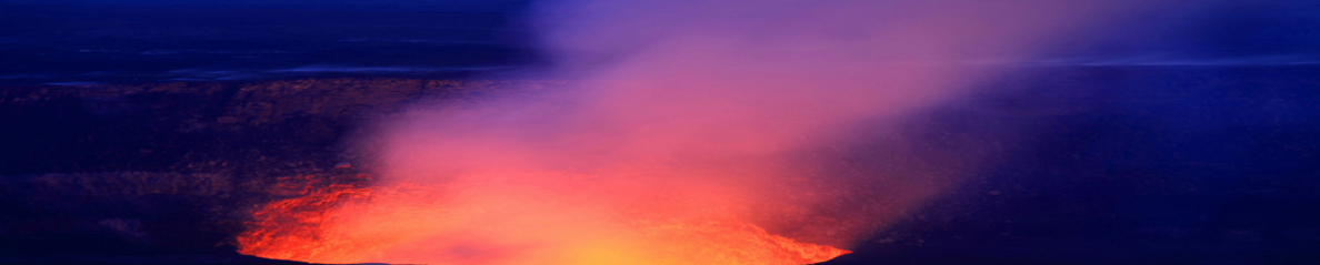
La route n°1 est ouverte dans son intégralité, même à proximité de l’Eyjafjallajökull. Toutefois, les automobilistes sont invités à conduire prudemment à cause des travaux en cours.
La zone d’interdiction autour de l’Eyjafjöll vient d’être réduite et l’on peut à nouveau accéder au Solheimajokull et même au Myrdalsjokull dont la partie ouest reste interdite.
La route qui conduit au col de Fimmvorduhals reste fermée et le site de la première phase de l’éruption est toujours interdit d’accès. Il en va de même de l’accès à Thorsmork car la piste a été endommagée par les inondations sur 6 kilomètres.
Les avions resteront cloués au sol aujourd’hui dans le sud-ouest de l’Islande, mais les aéroports d’Akureyri et Egilsstadir continuent à fonctionner normalement.
Source : Iceland Review.
 Here is some information for the attention of those who intend to visit Iceland in the coming days.
Route 1 is open all around Iceland, even near Eyjafjallajokull, but motorists are advised to drive with care due to ongoing repair work to the road.
The area around the volcano declared off limits to public access has been shrunk and the public are once again allowed access to Solheimajokull path and even onto Myrdalsjokull.
The route up to Fimmvorduhals remains closed, including the site of the recently-stopped Fimmvorduhals volcano. The westernmost parts of Myrdalsjokull are also closed. Thorsmork also remains closed, as a six-kilometre stretch of road has been severely damaged by flooding.
Flights in southwest Iceland are grounded today, but the airports at Akureyri and Egilsstadir remain open.
Source : Iceland Review.
 Suite à une augmentation de la sismicité accompagnée de l’apparition de séismes à haute énergie et de séquences de tremor atteignant parfois une durée de 20 minutes, le SERNAGEOMIN a élevé le niveau d’alerte de la couleur Jaune Niveau 3 à la couleur Jaune Niveau 4 le 25 avril.
 Owing to an increase in seismicity with ‘the occurrence of earthquakes with high energy levels and tremor signals with durations of up to 20 minutes’, SERNAGEOMIN raised the alert level from Yellow Level 3 to Yellow Level 4 on April 25th.
 Comme je l’ai indiqué précédemment, l’activité se poursuit, avec des plans d’évacuation préparés par le gouvernement. La NASA vient de diffuser une nouvelle et belle photo de Gaua (voir ci-dessous) prise le 24 avril par le système Advanced Land Imager à bord du satellite EO-1 d’observation de la Terre. Les zones de couleur marron dans la partie gauche de l’image, à l’ouest et au sud-ouest du volcan, sont celles où la cendre et les émissions volcaniques ont affecté ou tué la végétation.
 As I put it previously, activity is continuing, with evacuations planned by the government. NASA has just provided another excellent satellite image of Gaua (seee here below), captured on April 24th by the Advanced Land Imager aboard the Earth Observing-1 (EO-1) satellite. The brown areas on the left of the image, to the west and south-west of the volcano, show where volcanic emissions and ashfall have damaged and killed vegetation.
 Barren Island (ou Ile Barren, l’île aride) n’est pas le plus connu des volcans de la planète. C’est une île faisant partie des Andaman, archipel qui appartient à l’Inde. C’est le seul volcan actif d’un arc orienté nord-sud qui s’étire entre Sumatra et la Birmanie. L’île culmine à 354 mètres d’altitude, mais elle s’élève en réalité de 2250 mètres depuis le fond de l’océan. Inhabitée, elle consiste en une caldeira de 2 km de large qui s’ouvre sur la mer vers l’ouest et qui a été créée par une violente explosion à la fin du Pliocène. Un cône a été édifié dans cette caldeira par des éruptions historiques, avec des coulées de lave qui ont parfois atteint la mer.
 Barren Island is not the best-known volcano on Earth. It is an island which is part of the Andaman Islands, an archipelago that belongs to India. It is the only active volcano along the N-S-trending volcanic arc extending between Sumatra and Burma. The 354-m-high island is the emergent summit of a volcano that rises from a depth of about 2,250 m. The island is uninhabited and contains a 2-km-wide caldera which is open to the sea on the W and which was created during a major explosive eruption in the late Pleistocene. A cone was constructed in the centre of the caldera by historical eruptions, with lava flows that sometimes reached the sea.