La fonte des glaciers islandais (suite) // The melting of Icelandic glaciers (continued)

Des glaciologues de l’Université de Dundee (Écosse) ont publié une vidéo en accéléré montrant la fonte rapide du glacier Breiðamerkurjökull dans le sud-est de l’Islande. J’ai déjà écrit plusieurs notes sur ce blog dans lesquelles la fonte de ce glacier est mentionnée (le 8 décembre 2019, par exemple). Au cours de l’été 2021, les scientifiques ont installé deux caméras en bordure du Breiðamerkurjökull, une langue du Vatnajökull. Les caméras ont filmé pendant six semaines.
Les glaciologues indiquent que la vitesse rapide de fonte des glaciers pendant l’été a un impact significatif sur leur récupération pendant les mois d’hiver. Lorsqu’un glacier est en équilibre, l’accumulation hivernale équivaut à la fonte estivale, mais cela ne se produit plus sur le Breiðamerkurjökull. L’ablation s’est accélérée et au cours des dernières décennies, l’accumulation de neige hivernale n’a pas suffi à alimenter le glacier. Il s’en est suivi un recul atteignant 250 m par an..
Source : Sky News.
Vous pouvez regarder la vidéo en accéléré en cliquant sur ce lien :
https://news.sky.com/story/climate-change-icelandic-glacier-melting-faster-than-it-can-recover-experts-warn-12464649

————————————————-

Glaciologists from the University of Dundee (Scotland) have released a time-lapse video showing the rapid melting of Breiðamerkurjökull glacier in Southeast Iceland. I have already written several posts in which this glacier is mentioned (December 8th, 2019, for instance).

In the summer 2021, the scientists insta lled two time-lapse cameras at Breiðamerkurjökull which is an outlet glacier of Vatnajökull. The cameras kept filming over a period of six weeks.

Experts have highlighted that the rapid rate of melting glaciers during the summertime has now significantly impacted recovery during the winter months.When a glacier is in balance the winter accumulation would equal the summer melt, but this does not happen at Breiðamerkurjökull .The ablation has accelerated beyond recovery and in recent decades a retreat of up to 250m per year has been recorded.

Source: Sky News.

You can watch the time-lapse video by clicking in this link:

https://news.sky.com/story/climate-change-icelandic-glacier-melting-faster-than-it-can-recover-experts-warn-12464649

Quelques vues du Vatnajökull en juillet 2021 (Photos: C. Grandpey)

Nouvelles d’Islande // News from Iceland

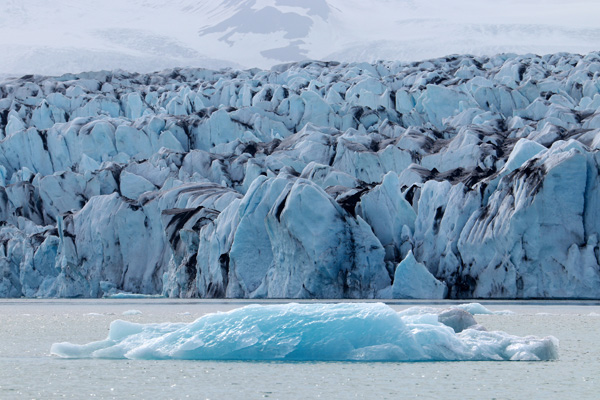
Le 17 novembre, j’indiquais que, selon un rapport publié le 16 novembre 2021, une phase d’inflation avait été détectée en profondeur sous la montagne Fagradalsfjall. Cette inflation pourrait signifier qu’une activité éruptive est susceptible de reprendre dans la région, mais personne ne sait quand une telle éruption est susceptible de commencer
Aujourd’hui, les médias islandais nous informent qu’un séisme de magnitude M 3.0 a été enregistré sur la péninsule de Reykjanes, dans la soirée du 17 novembre. L’épicentre se trouvait à 3,5 km au nord-est de Grindavík. Quelques répliques ont également été enregistrées. De plus, un essaim sismique a débuté le même jour près dans le secteur de Þrengsli (sud-ouest de l’Islande) avec un événement de M 3,3.
Le Met Office islandais affirme que les habitants de Grindavik ne doivent pas être inquiets.De tels séismes sont probablement dus à la position de la région à la limite des plaques tectoniques, de sorte que l’activité sismique n’y est pas rare. Selon le Met Office, cette sismicité n’a aucun lien avec une activité volcanique.

Les médias islandais informent également le public que le sol a recommencé à se soulever sur la péninsule de Reykjanes. L’inflation a été détectée au nord du mont Keilir et au sud du site de l’éruption du Fagradalsfjall.
Le sol autour du Fagradalsfjall a montré une déflation pendant l’éruption elle-même, très probablement parce que le magma quittait la chambre magmatique pour s’écouler en surface. D’après les mesures GPS, la déflation a commencé à s’atténuer fin août, puis à s’intensifier vers la mi-septembre. Elle est toutefois minime et n’atteint que un à deux centimètres maximum.
Selon les modèles du Met Office, l’accumulation de magma en profondeur est la cause la plus probable de l’inflation, bien que les scientifiques pensent également qu’elle peut être liée à l’activité sismique enregistrée pendant un mois au sud de Keilir à la fin septembre. Aucun mouvement de terrain laissant supposer que le magma se rapproche de la surface n’a été observé. Aucune coulée de lave n’a été observée sur le Fagradalsfjall depuis le 18 septembre. Des émissions de gaz en très faible quantité sont toujours détectées sur le site de l’éruption.

Le Center for Disease Control (CDC) aux États-Unis a élevé cette semaine l’Islande niveau 4, autrement dit à très haut risque, en raison du nombre élevé de cas de COVID-19 dans le pays. Le niveau 4 est attribué aux pays ayant enregistré plus de 500 cas pour 100 000 habitants au cours des 28 derniers jours.
La République tchèque, la Hongrie et Guernesey ont également été classées au niveau 4 dans le même temps. La Belgique, les Pays-Bas, Singapour, la Turquie et les îles Vierges font partie des 70 destinations dans le monde que le CDC considère comme étant à très haut risque en ce moment.
Le CDC conseille aux résidents américains de ne pas se rendre en Islande actuellement. Ils doivent entreprendre le voyage uniquement s’ils sont vaccinés (comme l’exige également l’Islande) et suivre les réglementations locales sur le port du masque et la distanciation sociale.

Sources: Iceland Monitor, Iceland Review.

—————————————-

On November 17th, I indicated that, according to a news report published on November 16th, 2021, inflation had been detected deep under Fagradalsfjall mountain. This inflation suggests that an eruption might start again in Fagradalsfjall, but it remains impossible to know when such an eruption might start

Today, Icelandic news media inform us that an M 3.0 earthquake hit the Reykjanes peninsula, in the evening of November 17th . Its source was 3.5 km northeast of Grindavík. Some aftershocks were also recorded. In addition, a seismic swarm began on the same day near the Þrengsli area (southwest Iceland) with an event measuring M 3.3.

A Met Office says there is no reason for Grindavik residents to be too worried. The cause of the quakes is probably due to the tectonic plate boundary in the region, and seismic activity in the area is not at all uncommon. He adds there is no indication of a connection to any volcanic activity.

Icelandic news media also inform the public that land has started rising again on the Reykjanes peninsula. The uplift has been detected north of Mt. Keilir and south of the Fagradalsfjall eruption site.

The land around Fagradalsfjall fell during the eruption itself, most likely because of the magma streaming out of the chamber beneath the surface. According to GPS measurements, land fall began to subside at the end of August and then rise again around the middle of September. The uplift is, however, minimal: only one to two centimetres at the highest points.

According to the Met Office’s models, the magma accumulation deep within the earth is the most likely cause of the uplift, although scientists also believe that it is connected to a month-long wave of seismic activity that began at the southern end of Keilir at the end of September. No dislocation has been observed on the surface as of this time, which might mean that magma is getting closer to the surface. There has been no lava flow at Fagradalsfjall since September 18th. Gas emissions are still being detected at the eruption site, but only in very small quantities.

The United States’ Center for Disease Control (CDC) has just designated Iceland Level 4, or Very High Risk, for travellers this week, due to the nation’s high COVID-19 rates. Level 4 is a designation reserved for nations with more than 500 cases per 100,000 residents in the past 28 days.

The Czech Republic, Hungary, and Guernsey were also listed as Level 4 at the same time. Belgium, The Netherlands, Singapore, Turkey, and the US Virgin Islands are among the 70 destinations around the world that the CDC has designated as Very High Risk at this time.

The CDC advises US residents not to travel to Iceland at this time. Americans who do choose to travel to Iceland are advised only to do so if vaccinated (as required by Iceland as well) and to follow local regulations on mask wearing and social distancing.

Sources: Iceland Monitor, Iceland Review.

On n’observe qu’un faible dégazage sur le site de Fagradalsfjall.

Nouvelles d’Islande // News from Iceland

Après l’éruption du Fagradalsfjall, on a beaucoup parlé d’un possible réveil de l’Hekla. Aujourd’hui, on assiste au retour du Fagradalsfjall ! Je viens de lire sur le site web Iceland Geology l’article suivant : « Selon un rapport scientifique publié le 16 novembre 2021, une inflation a été détectée en profondeur sous la montagne Fagradalsfjall. Cette inflation laisse supposer qu’une éruption pourrait recommencer à Fagradalsfjall, mais il est impossible de savoir quand une telle éruption pourrait commencer. Il y a beaucoup de choses qui indiquent que cette inflation est due à une accumulation de magma en profondeur sous le Fagradalsfjall. Quand ou si cela entraîne une éruption dans le futur est impossible à savoir. Cette inflation est maintenant suffisamment importante pour être vue sur les images satellites qui surveillent la déformation de la croûte supérieure. »
Source : Iceland Geology.

°°°°°°°°°°

Au cours de l’automne, une nouvelle grotte de glace d’une taille inhabituelle a été découverte dans la partie orientale du Langjökull. Un voyagiste a amélioré l’accès à la grotte et s’est assuré que lson plafond ne s’effondrerait pas; un éclairage a été installé car la grotte est trop grande et trop profonde pour que des lampes frontales suffisent à l’éclairer. Aujourd’hui, deux agences de voyages islandaises conduisent leurs clients dans la grotte qui est en passe de devenir une nouvelles attraction touristique.
Source: Iceland Monitor.

—————————————–

After Fagradalsfjall there was much talk about a possible eruption of Hekla. Today, Fagradalsfjall is back again! I have just read on the website Iceland Geology: « According to a news report today (November 16th, 2021) inflation has been detected deep under Fagradalsfjall mountain. This inflation suggests that an eruption might start again in Fagradalsfjall, but it remains impossible to know when such an eruption might start. There is a lot that suggests this inflation is because of magma collecting at depth under Fagradalsfjall. When or if that results in a eruption in the future is impossible to know.This inflation is now large enough to be seen on satellite images that monitors deformation in the upper crust. »

Source: Iceland Geology.

°°°°°°°°°°

Earlier in the fall, a new and unusually large ice cave was discovered on the east side of Langjökull glacier. A tour operator started improving access to the cave and made sure ice wouldn’t collapse from the ceiling; and they designed and installed lighting. The cave is too large and deep for headlights alone to suffice to illuminate it. Today, two Icelandic travel agencies are taking tourists to the cave.

Source: Iceland Monitor.

Le Fagradalsfjall sortira-t-il de sa torpeur pour se donner à nouveau en spectacle (captures écran webcam)

Volcans islandais : A qui le tour? // Icelandic volcanoes : who’s next?

Bien que l’éruption du Fagradalsfjall ne soit pas officiellement terminée, le volcan est pratiquement inactif en ce moment et il est hautement improbable qu’il entre à nouveau en éruption. Cela signifie qu’il n’y a actuellement aucune éruption en Islande et certains volcanologues se tournent vers d’autres volcans pour faire des prévisions. Selon l’humeur du moment, ils nous parlent du Katla ou du Bardarbunga, ou encore du Krafla.

Ces jours-ci, l’intérêt se porte sur l’Hekla (1491 m) dans le sud du pays où une crise sismique avec plus de 320 événements a été enregistrée à proximité du volcan le 11 novembre 2021. Le séisme le plus puissant avait une magnitude de M 5,2. Sa source a été localisée dans les montagnes Vatnafjöll, à environ 7,5 km au sud de l’Hekla. Il a été largement ressenti dans le sud de l’Islande, ainsi que dans la région de Reykjavik.
Selon le Met Office islandais, il n’y a aucune raison de penser que cette activité sismique annonce une éruption de l’Hekla. En effet, la sismicité a été enregistrée dans la partie orientale de la zone de fracture de 70 km de long qui parcourt le sud de l’Islande.

Depuis l’an 2000, date de la dernière éruption de l’Hekla, on observe une inflation constante du volcan .En 2006, elle atteignait le niveau d’avant l’éruption de 2000, mais aucune éruption n’a eu lieu. De nombreux volcanologues islandais pensent aujourd’hui que le volcan est prêt à se manifester
Le problème avec l’Hekla, c’est qu’il n’y a pas vraiment de signes précurseurs avant une éruption, ce qui rend le volcan particulièrement dangereux.
Il semble que la pression qui provoque l’inflation provienne d’une profondeur de 15 à 20 km, là où le magma semble s’accumuler. D’après les mesures de déformation, c’est là que se trouve la source des éruptions. .
Certains volcanologues pensent que l’Hekla entre en éruption selon un cycle, même si la notion de cycle éruptif n’a jamais été clairement prouvée en volcanologie. L’Hekla avait pour habitude de se manifester deux fois par siècle. Une grande éruption s’est produite en 1947, suivie d’une éruption surprise en 1970. Par la suite, le volcan est entré en éruption en 1980, 1991 et 2000, ce qui a donné naissance à l’idée d’un cycle éruptif pour ce volcan. Cependant, quand on regarde la fréquence des éruptions du passé, il y a des ratés et la notion de cycle disparaît. Les dernières éruptions étaient relativement mineures, mais les scientifiques expliquent que plus une pause entre les éruptions est longue, plus l’éruption est importante. Là encore, l’histoire des volcans montre qu’il existe des exceptions.
La dernière fois que l’Hekla est entré en éruption, il n’a prévenu que 79 minutes avant l’événement. En 1980, le préavis a été seulement de 23 minutes. Les personnes les plus à risque sont celles qui font de la randonnée en montagne, car il peut être difficile de fuir en cas de colère du volcan. C’est la raison pour laquelle il est déconseillé aux touristes d’escalader le volcan ; seuls les scientifiques qui ont un besoin urgent de collecter des données devraient pouvoir gravir la montagne. Un autre problème pourrait concerner les avions qui survolent le volcan, mais les autorités islandaises pensent qu’il n’y a pas de mesures particulières à prendre concernant les survols de l’Islande au regard des risques d’éruptions. Il ne faudrait quand même pas oublier celle de l’Eyfjallajökull en 2010… !
Source : Iceland Monitor.

——————————————————-

Although the Fagradalsfjall eruption is not officially over, the volcano is nearly inactive and it is highly unlikely that it will erupt again. This means yhere is currently no eruption in Iceland and some volcanologists are turning to other volcanoes to make predictions. Depending on their moods, they tell us about Katla or Bardarbunga, or else Krafla.

This time the interest is focused on Hekla (1491 m) in the south of the country where a seismic crisis with more than 320 events was recorded in the vicinity of the volcano on November 11th, 2021, The largest earthquake was of magnitude M 5.2. Its source was by Vatnafjöll mountains, about 7.5 km south of Hekla. It was widely felt in South Iceland, as well as in the capital area.

According to the Icelandic Met Office, there is no reason to think there is a connection between the seismic activity and a potential eruption in Hekla. Indeed, the earthquakes occurred on the easternmost side of the 70-km-long South Iceland fracture zone,

Since the year 2000, when Hekla last erupted, inflation has steadily increased in the mountain In 2006, the inflation was as extensive as it had been before the 2000 eruption. Many Icelandic volcanologists think the volcano is ready for an eruption.

The problem with Hekla is that there are no real precursors before an eruption, which makes it very dangerous.

It looks as if the pressure that causes the inflation originates at a depth of 15-20 km where magma appears to accumulate. According to deformation measurements, it is the source of the eruptions. .

Some volcanologists think Hekla erupts according to a cycle, even though the notion of eruptive cycle has never been clearly proved in volcanology. Hekla used to erupt twice a century. A large eruption occurred in 1947, followed by a surprise eruption in 1970. Subsequently, it erupted in 1980, 1991 and 2000, which gave borth to the idea of an eruptive cycle for this volcano. However, when one looks at the frequency of other past eruptions, the notion of cycle disappears. The last eruptions were fairly small, but scientists say that the longer a break between eruptions, the larger the eruption, Here again, the history of volcanoes shows that there are exceptions.

The last time Hekla erupted, it gave only a 79 minute notice. In 1980, the notice was no more than 23 minutes. Those at the greatest risk are people who are hiking in the mountain, because escaping could be difficult. This is the reason why tourists are advised not tp climb the volcano; only those who urgently need to collect data should hike up the mountain. Another problem might concern the planes who fly over the volcano, but Icelandait authorities think that no change needs to be made regarding flights over Iceland with regard to the risk of eruptions…without mentioning forgetting Eyfjallajökull, of course!

Source: Iceland Monitor.

Crédit photo: Wikipedia