7h30 (heure française) / 6h30 en Islande : La sismicité est toujours très forte ce matin (11 novembre 2023) et la ville de Grindavik (3500 habitants) a été évacuée, car les autorités craignent que l’intrusion magmatique détectée sous la ville n’atteigne la surface. A noter qu’il s’agit d’une « évacuation obligatoire », mais pas d’une « évacuation d’urgence », qui nécessiterait de quitter la ville dans un délai de 30 minutes. Les habitants n’ont donc pas besoin de se précipiter pour quitter leur domicile. On leur demande de couper l’électricité et de fermer toutes les fenêtres en partant. Il leur est en outre demandé d’afficher un papier sur la porte ou la fenêtre donnant sur la rue indiquant que la maison a été évacuée.
À ce stade, il n’est pas possible de déterminer exactement si et où le magma pourrait atteindre la surface. Il semble qu’une quantité considérable se déplace dans une zone s’étendant de Sundhnjúkagígum au nord vers Grindavík. Le volume de magma accumulé dépasse celui des trois dernières éruptions dans la région. Une situation d’urgence a été décidée et la Croix-Rouge a mis en place trois centres de secours. Un établissement pour personnes handicapées et une maison de retraite pour personnes âgées, gravement endommagées lors des récents séismes, ont été évacués hier soir avant que l’évacuation obligatoire ne soit imposée.
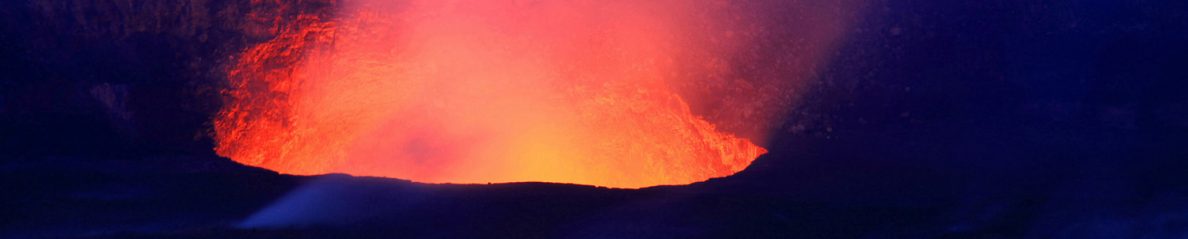
L’Islande est aujourd’hui confrontée à des événements que les Islandais n’ont jamais vécus depuis longtemps, comme l’éruption des îles Westman.
Grindavíkurvegur, la route qui conduit à Grindavík depuis Reykjanesbrautin, a également été fermée hier soir en raison d’une grande fissure qui s’est formée sur la chaussée. L’Administration routière a effectué des réparations d’urgence, mais la route restera fermée.
Source : Iceland Monitor.

Source: Met Office
++++++++++
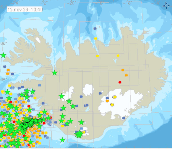
13h00 : Le Met Office indique que depuis minuit, quelque 800 séismes ont été enregistrés dans la zone où se produit l’intrusion magmatique. L’activité sismique a légèrement diminué pendant une courte période avant de reprendre et elle reste élevée. La plupart des dernières secoussesse sont produites près de Grindavík, où l’on estime que se trouve l’extrémité sud-ouest du dyke magmatique.
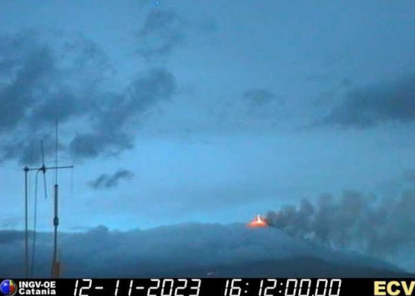
Les données sismiques indiquent que l’intrusion magmatique s’étend de Stóra-Skógsfell au nord jusqu’à Grindavík au sud, avant de se prolonger sous la mer. Conformément aux derniers modèles préliminaires qui utilisent les dernières données satellitaires acquises le 10 novembre au soir, la partie supérieure de l’intrusion magmatique, au nord de Grindavík, se trouve à 1,5 km sous la surface. C’est là que la profondeur est la plus faible. L’interprétation conjointe des mesures au sol et des données satellitaires indique que la taille de l’intrusion magmatique et la vitesse à laquelle elle se propage sont plusieurs fois supérieures à celles observées précédemment sur la péninsule de Reykjanes. S’il y a éruption, la lave émergera probablement dans la partie nord de l’intrusion magmatique. Cela signifie qu’il est probable qu’une éruption commence près de Sundhnjúkagígur. Le Met Office conclut sa mise à jour en disant que la probabilité qu’une éruption volcanique se produise dans un avenir proche est « considérable. »
Source: Met Office
++++++++++
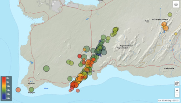
20h00 : Une réunion tenue dans la soirée du 11 novembre et réunissant des scientifiques du Met Office, de l’Université d’Islande et du Département de Protection civile a conclu que l’intrusion magmatique en cours représente un réel risque d’éruption. On estime que l’intrusion se propage lentement vers la surface et que le magma se trouve à 800 m de profondeur. Le site exact d’une éventuelle éruption reste inconnu, mais la longueur de 15 km et l’orientation du dyke donnent une bonne indication des possibilités. Une éruption pourrait se produire dans quelques jours seulement. Au vu de l’étendue du dyke, la lave pourrait émerger dans sa partie sud, juste à l’extérieur de Grindavik. Par conséquent, la probabilité d’une éruption sous-marine n’est pas à négliger ; il faut donc se préparer à la possibilité d’une activité explosive. Une zone à risque a été définie en fonction de l’emplacement du dyke, comme on peut le voir sur la carte ci-dessous.
Source : MetOffice.

Carte montrant l’emplacement de l’intrusion de la digue (Source : Met Office)
——————————————
 7:30 (French time) / 6:30 in Iceland : Seismicity is still very strong this morning (November 11th, 2023) and the town of Grindavik (pop; 3,500) has been evacuated amid concerns that the magma intrusion, believed to extend beneath the town, may reach the surface. It is a « mandatory evacuation », not an “emergency evacuation,” which would require the town to be vacated within 30 minutes. Residents do not have to ryun to leave their homes. They are told to turn off the electricity and close all windows when leaving. They are further asked to post a paper on the door or street-facing window indicating that the home has been evacuated.
At this stage, it is not possible to determine exactly whether and where magma might reach the surface. There are indications that a considerable amount of magma is moving in an area extending from Sundhnjúkagígum in the north towards Grindavík. The volume of magma that has accumulated has surpassed that of the previous three eruptions in the area. An emergency phase has been declared, and the Red Cross has set up three emergency relief centres. A residential facility for disabled individuals and a nursing home for the elderly, severely damaged in recent earthquakes, were evacuated last night prior to the mandatory evacuation being imposed.
Iceland is dealing with events that Icelanders have not experienced before, at least not since the eruption in the Westman Islands.
Grindavíkurvegur, a road leading to Grindavík from Reykjanesbrautin, was also closed last night due to a large crack that formed in the middle of it. The Road Administration has completed emergency repairs, but the road will remain closed.
Source : Iceland Monitor.
++++++++++
13:00 : The Met Office indicates that since midnight, around 800 earthquakes have been recorded in the area of the magma intrusion. Seismic activity slightly declined for a short time before increasing again and it remains high. Most of the recent earthquakes have occurred close to Grindavík, where the southwest end of the magmatic dyke is estimated to be located.
The seismic data indicates that the magma intrusion extends from Stóra-Skógsfell in the north to Grindavík in the south, where it extends beneath the sea. In accordance with the latest preliminary models, using the most recent satellite data acquired on November 10th in the evening, the shallowest depth of the top of the magma intrusion north of Grindavík is 1.5 km. Joint interpretation of the ground and satellite measurements indicate that the size of the magma intrusion and the rate at which it is moving are several times larger than have been measured previously on the Reykjanes Peninsula. Should an eruption occur, lava is most likely to emerge from the northern side of the magma intrusion. This means that there is a greater likelihood of an eruption beginning close to Sundhnjúkagígur. The Met Office concludes its update saying that the likelihood of a volcanic eruption occurring in the near future is deemed considerable.
++++++++++
08:00 pm : A meeting held in the evening of November 11th and including scientists at the Icelandic Meteorological Office, the University of Iceland, and the Department of Civil Protection concluded that the ongoing dike intrusion represents a serious volcanic hazard. It is estimated that the intrusion is propagating upwards slowly, with magma thought to be 800 m beneath the surface. The exact location of a possible eruption site is unknown, but the 15-km length and orientation of the dike gives a good indication of possible sources. An eruption could be possible on a timescale of just days. Based on the extent of the dike, magma could emerge from its southern part, just outside of Grindavik. Therefore, the likelihood of a submarine eruption has also increased, so preparations must be made for the possibility of explosive activity. A hazard area has been defined based on the location of the dike, as shown in the map.
Source : Met Office.