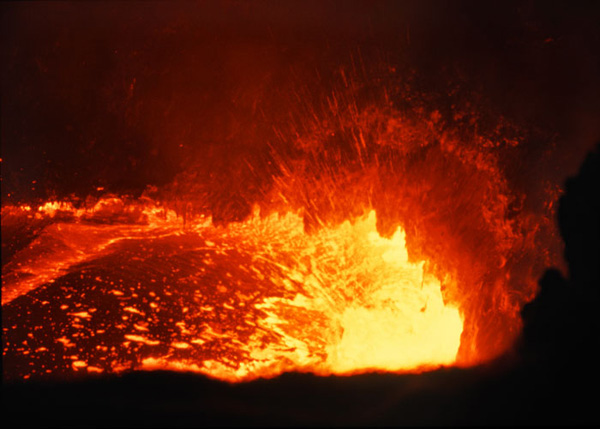
In the past days there has been a reactivation of mud emissions in the Paterno salinelle. The mud flowed several times in Via Salso, to the great despair of the residents who had to clean up their yards and gardens. However, the phenomenon is not exceptional. I studied it in the years 2000, together with the gaseous emissions on the lower slopes of Mount Etna. Here is a summary of my study.
GASEOUS EMISSIONS ON THE LOWER SLOPES OF MOUNT ETNA
Referring to statistics, Etna is said to be one of the most polluting volcanoes in the world, because of heavy emissions of gas. According to T.M. Gerlach (1), the craters emit some 25,000 tons of CO2 per day, which corresponds to 10% of the CO2 of volcanic origin on our planet.
Generalities :
The sources of CO2 on the lower slopes of Mt Etna are essentially concentrated around Paterno (where they are better known as salinelle owing to their strong salinity) but also in the Bronte and Giarre areas.
Let’s not forget the gas emissions located along the 1989 fracture, at about 1650 m a.s.l., where it crosses the SP.92 provincial road. Owing to a magma intrusion, this fissural system – which, by the way, was reactivated during the 1991-93 eruption – represents a potential risk for some villages, hence the need for an increased surveillance.
The emissions of gases at a low altitudes might be explained by the presence of thinner clay-rich layers that would allow their passage.
These emissions of gas have been known for a very long time and several studies already mentioned them as early as the 19th century (2). By that time, the reports sometimes described fountains of mud-rich water that could reach heights ranging from 50 cm to 3 metres, with an average temperature of 46°C. These mud paroxysms were often connected to seismic events in the area.
The salinelle of Paterno.
Salinelle are mud volcanoes that are located in three sites around Paterno :
• Site n°1 – Simeto – lies to the west of the town, close to the river with the same name.
• Site n°2 – Stadio – lies close to the football ground ; it is undoubtedly the best known and the most accessible; today, it is a waste ground lined with heaps of rubbish. Due to the instability of the ground, visitors need to be careful because the crust may break and cause a very unpleasant foot-bath, even if it is without danger!
• Site 3 – Vallone Salato – lies to the south-east. .
Each site covers several thousand square metres. The mud pools have a strong salinity, an average PH of 6 and a conductivity of 88ms/cm. In most cases, the water temperature is about 19°C; for instance, I measured temperatures between 18°1 and 20°3°C on the site of Stadio. Some differences can be noted between one spring and another, but they are on the whole very stable, whether it be in Spring or in Summer when I made the measurements. The chemical composition (on an equivalent basis) is as follows:
Na » Ca > Mg > K et Cl » HCO 3 > SO4 (3)
The strong salinity, the low rate of sulphates and the absence of seasonal variations in the chemical composition mean that they are waters associated with hydrocarbon deposits.
Apart from the Paterno salinelle, one can observe other places where gases are released in some amounts. For example, the spring of Aqua Grassa, not far from Paterno, releases about 20 cubic metres of gas each day. In the past, the CO2 was exploited for the industry. In 1937 the emission rate even reached 100 m3 per day (4). The water temperature is 19°C and its PH is 6.
The salse (4) of Fondachello – near Giarre – were famous for their mud eruptions in the 17th century, perhaps in relation with the earthquake that destroyed Catania (5).
The mud fountains were sometimes as high as six metres and the texts of that time mention a “vulcano di fango” – a mud volcano – that was salt-rich and three metres high. Other eruptions, though less dramatic, took place during the following centuries (6). However, there does not seem to exist any description of a recent activity, even if the inhabitants pretend that a mud volcano, one metre high, was still active some twenty years ago and that its gases were used to cook the meals!…
Today the gas activity is limited to emissions of bubbles in an irrigation ditch which is difficult to find.
Mofettes or gas emissions of the same type can also be observed near Santa Venerina (near Acireale), at San Nicola (near Bronte), at Nafta (near Palagonia) or at Aragona, although in these last two places the phenomenon is probably not linked to Mt Etna.
The gases of the salinelle.(7)
In the salinelle, the main gases are: CO2 (largely dominant), CH4, N2 and He. Each mud pool presents very little chemical variation with the time, but the chemical composition may vary from one pool to another, even if they are not far the ones from the others. Geothermal studies based on the composition of the water and the gases of the salinelle may lead to think that the temperature of the feeding system is comprised between 100 and 150°C.
Each salinella has its own relation He / CH4 which remains constant in time and space. On the contrary, CO2 may vary because, during its ascent, it undergoes different interactions with the waters of the different pools, whereas He and CH4 only have a low solubility in water.
The studies performed in the past (Silvestri in the 19th century) reveal a strong concentration of H2 in the salinelle whereas today the presence of this gas is very rare. However, a characteristic odour of H2S is present on the sites of the salinelle.
Salinelle and seismology:
According to D’Alessandro, some salinelle show variations of chemical composition in relation with the seismic events that took place in the eastern part of Sicily between 1990 and 1993. These variations concern:
• the concentrations of CH4 and He at the Stadio salinella in Paterno (in relation with an earthquake that took place on December 13th 1990).
• the concentrations de H2, He, CH4 at Stadio and Vallone Salato (in relation with an earthquake that took place on September 20th 1991).
It could not be proved whether the variations in the chemical composition of the gases preceded or not the tremors.
The change in H2 may be attributed to reactions between water and the surface of silicate-rich rocks. Such reactions (and thus the emission of H2) are increased when the rocks undergo micro-fractures at the moment an earthquake is about to occur.
The changes in He and CH4 could be explained by variations of pressure exerted on the deep magmatic chamber during the period that precedes the earthquake.
To be confirmed, these hypotheses would require more precise and more regular studies, along with an automatic system of control that would allow to measure some parameters of the fluids (PH, temperature, CH4, He, etc.); this might contribute to setting up a surveillance program in relation with seismic activity.
Relationship between gas emissions at low altitude and the eruptive activity of Mt Etna.
Volcanic activity is often heralded by geochemical signals , such as changes in the chemical composition of fumaroles or crater lakes. Paradoxically, very little research has been performed on gas emissions at ground level in volcanic areas. However, abnormal concentrations in the emissions of rare gases from the ground have already been observed during periods of seismic activity. During a pre-eruptive phase, micro-fractures in the rocks increase the permeability of the ground and thus favour the passage of the gases accumulated under the volcanic structure.
In Italy, changes in CO2, Rn, He concentrations have been observed on such sites as the Campi Phlegrei (in repose today), Stromboli or Etna (active today). The study of these gases can thus be a precious indicator of the evolutive process inside an active volcano.
That’s why, since 1989, scientists from the CNR and of the University of Palermo have undertaken a systematic study of the gases in particular areas around Mount Etna:
• Zafferana Etnea / San Venerina , where 69 measuring points have been set up over 42 km2 at 600 m a.s.l.
• Paterno, with 69 measuring points over 45 km² at 200 m a.s.l.
• The south/south-east fracture that split open Etna’s flank in 1989 between the South-East Crater and the 1500 m altitude.
This study was intensified at the end of 1989, 1991 and at the beginning of 1992 during eruptive crises of the volcano. Two types of measurements of CO2 have been performed: punctual (with monthly readings) and continuous (by means of a station installed on the lower part of the 1989 fracture).
During the measurements, three anomalies were recorded in the area Zafferana / S. Venerina in Summer 1990, March-April 1991 and October 1991, respectively.
In Paterno, only the March-April anomaly was recorded.
On the 1989 fracture, a degassing anomaly was observed in April-August 1990 and September-October 1991, which corresponds with two of the vents recorded in Zafferana / S. Venerina.
The result of these different observations reveals an increase in CO2 in March-April, which was only detected in the peripheral areas but not on the 1989 fracture. This increase in CO2 corresponded with a period of inflation of the volcano and thus an accumulation of pressure in depth.
As a consequence, it looks as if peripheral areas receive a “loss of tectonic gas” linked to the deep feeding system of the volcano, and this depth is too great for the 1989 fracture – much too high in altitude – to be affected. The abnormal degassing of September-October 1991 that was also observed on the 1989 fracture and at Zafferana/S. Venerina (but not at Paterno) can be explained by an early magma intrusion in the fracture. The proximity of Zafferana and S. Venerina and the distance to Paterno account for the differences in the emissions between these two areas.
From these observations, it appears that the areas of Zafferana / S. Venerina on the one hand and Paterno on the other hand might have a common and deep source of CO2. The only increase proper to all these areas was recorded in early 1991, with a climax by the end of March. It was in relation with an inflation of the volcanic structure which was at the same time recorded by tiltmeters (SEAN 1992). This inflation of the volcano was due to an accumulation of pressure in depth which led to a new start of eruptive activity in mid-December.
Another increase (however much lower) of CO2 was observed in October 1991. Then, a sudden decrease occurred at low altitude – which was in relation with the start of the eruption – while, in the meantime, degassing was stronger on the summit of Etna. This suggests that the ascent of the magma column, while concentrating the main degassing in the upper feeding conduits, contributed to reducing exhalations in the peripheral areas.
Conclusion.
All these results show that the control and analysis of gas emissions at low altitude can allow to detect the early phases of a new activity of a volcano, likely to lead to an eruption. Besides, the control of gases in the area of a system of fractures like the one of 1989 may give indications about the behaviour of magma and then be used for the purpose of prevention.
+++++++++++++++++++
Most of the elements that allowed the writing of this report can be found in Acta Vulcanologica (Journal of the National Volcanic Group of Italy) / Vol. 4 – 1994 and Vol. 8 (1) – 1996. They complete a personal work of research and measurements on the field performed between 1994 and 1997.
++++++++++++++++++++++
(1) T.M. Gerlach. Etna’s greenhouse pump. (1991).
(2) G.A. Mercurio (1847) ou O. Silvestri (1866) for example.
(3) D’Alessandro, Parello, Valenza (1990-1993).
(4) A.G.I.P. (1938).
(5) G.A. Mercurio. Sulla Salsa di Fondachello nel commune di Mascali (1847)
(6) G.A. Mercurio. Sulla Salsa di Fondachello nel commune di Mascali (1847)
(7) D’Alessandro, Parello, Valenza. Acta Vulcanologica 8 (1). 1996.


The salinelle of Paterno in 1999 (Photos: C. Grandpey)
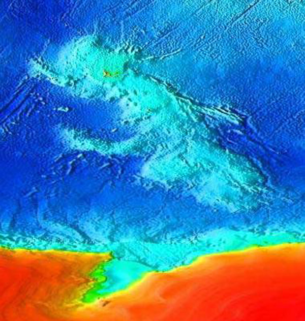
 Le navire de recherche scientifique Investigator, propriété de la Commonwealth Scientific and Industrial Research Organisation (CSIRO), vient de quitter Fremantle en Australie pour une mission de 58 jours dans l’Océan Austral, jusqu’aux îles subantarctiques Heard et McDonald. Le but est d’étudier le lien entre les volcans actifs sur les fonds marins et la production hydrothermale de fer qui permet la vie dans l’Océan Austral. Les îles sont situées à 4000 km au sud-ouest de Perth et à 2000 kilomètres au nord de la base australienne de Davis Station en Antarctique.
 The research vessel Investigator, owned by the Commonwealth Scientific and Industrial Research Organisation (CSIRO), has just left Fremantle in Australia on a 58-day Southern Ocean voyage to the subantarctic Heard and McDonald Islands. The aim is to research the link between active volcanoes on the seafloor and the mobilisation of iron which enriches and supports life in the Southern Ocean. The islands are situated 4,000 km south-west of Perth and 2,000 kilometres north of Australia’s base at Davis Station in Antarctica.