Pas d’éruption en vue sur l’Öræfajökull (Islande) // No short term eruption on Öræfajökull (Iceland)

Dix jours après que la couleur de l’alerte aérienne de l’Öræfajökull ait été élevée au Jaune, le géophysicien Magnus Tumi Guðmundsson affirme qu’il n’y a aucun signe d’éruption au niveau du glacier. Il confirme ce que j’ai écrit le 18 novembre: « Les données montrent qu’il existe une source de chaleur d’origine géothermale dans la région ». À mon avis, cette seule activité géothermale explique l’affaissement de la glace dans la caldeira et la formation d’un ‘chaudron’. La sismicité observée à cette époque était très superficielle et pouvait difficilement être causée par une ascension de magma. De plus, aucune augmentation significative du tremor n’a été observée.
Un autre géophysicien islandais, Ólafur Flóvenz, pense qu’une éruption a probablement lieu sous l’Öræfajökull et que le magma a probablement atteint la surface. Cependant, cela ne semble pas être le cas. La sismicité a chuté sur le glacier et aucun paramètre physique n’indique qu’une éruption a lieu ou est imminente. Par exemple, aucune crue majeure n’a été observée.
Comme je l’ai écrit le 24 novembre, un plan d’évacuation est prêt en cas d’éruption et la zone est étroitement surveillée.
Source: Iceland Review.

—————————————

Ten days after the aviation colour code for Öræfajökull was raised to Yellow, geophysicist Magnús Tumi Guðmundsson says there is no evidence of an eruption in the glacier. He confirms what I wrote on November 18th : “Data shows that there is geothermal heat in the area”. To my mind, this geothermal activity accounted for the collapse of the ice within the caldeira and the formation of a cauldron. The seismicity that was observed by that time was very shallow and could hardly have been caused by some magma ascent. Besides, no significant rise of the tremor had been observed.

Another Icelandic geophysicist, Ólafur Flóvenz, claimed that an eruption was most likely taking place in Öræfajökull and that the magma had most likely reached the surface. However, this does not seem to be the case. Seismicity has dropped on the glacier and no physical parameters indicate that an eruption is taking place or is imminent. No major flooding has been observed.

As I put it on November 24th, an evacuation plan is ready in case of an eruption and the area is closely monitored.

Source: Iceland Review.

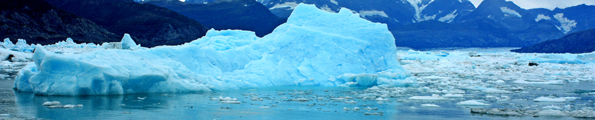
Image satellite de l’Öræfajökull (Source: ESA)

Le plan d’évacuation en cas d’éruption de l’Öræfajökull (Islande) // The evacuation plan in case of an eruption of Öræfajökull

Comme je l’ai indiqué dans une note publiée le 22 novembre 2017, un plan d’évacuation concernant l’Öræfajökull a été diffusé par la Protection Civile islandaise suite à l’augmentation d’activité montrée par le volcan au cours des derniers jours.
Selon le plan, si les ordres d’évacuation sont émis en raison d’une éruption imminente du volcan, les habitants de la zone concernée sont invités à se diriger immédiatement vers les trois points de rassemblement, les plus proches: Svínafell 1, Hof 1 ou Hnappavellir 2 (voir carte ci-dessous) et ils doivent attendre de nouvelles instructions en restant à l’intérieur de leurs véhicules.
Si la cendre ou les tepra émis par le volcan commencent à tomber, les gens sont invités à se mettre à l’abri dans le bâtiment le plus proche et à suivre les nouvelles instructions qui seront diffusées. Le plan d’évacuation d’urgence est accessible en cliquant sur ce lien:
http://icelandmonitor.mbl.is/news/nature_and_travel/2017/11/22/emergency_evacuation_plan_for_oraefajokull_volcano/

Les autorités islandaises rappellent à la population que le volcan Öræfajökull, dans le sud-est de l’Islande, est la plus haute montagne du pays, avec 2 110 mètres d’altitude. Le volcan est entré en éruption à deux reprises, en 1362 et 1727. Le volcan a récemment montré un regain d’activité avec une hausse de la sismicité et, plus tôt ce mois-ci, un affaissement d’un kilomètre de diamètre dans la calotte glaciaire au-dessus de la caldeira du volcan. À ce jour, il n’y a aucun signe d’éruption imminente. Suite à la dernière hausse d’activité, le volcan est surveillé très attentivement par les scientifiques et les autorités islandaises.
Source: Iceland Review.

—————————————–

As I put it in a note released on November 22nd 2017, an evacuation plan for the Öræfajökull volcano has been published by the Department of Civil Protection in Iceland in light of increased activity in recent days.

According to the plan, if evacuation orders are issued due to imminent eruption in the volcano, people in the area are instructed to immediately gather at three assembly points, whichever is closest: Svínafell 1, Hof 1, or Hnappavellir 2 (see map below) and wait in their vehicles for further instructions.

If volcanic ash or volcanic tepra starts falling, people are instructed to seek shelter in the nearest building and follow further instructions when they are issued. You will see the detailed emergency evacuation plan by clicking on this link:

http://icelandmonitor.mbl.is/news/nature_and_travel/2017/11/22/emergency_evacuation_plan_for_oraefajokull_volcano/

Icelandic authorities remind the population that Öræfajökull volcano in South-East Iceland is the country’s highest mountain, at 2,110 meters.. The volcano has erupted twice since Iceland was settled, in 1362 and 1727. The volcano has shown some signs of unrest recently, increased seismic activity, and earlier this month a new ice-cauldron measuring one kilometer in diameter formed in the glacial ice-cap over the volcano’s caldera. As of now there is no sign of imminent eruption. But in light of increased activity, the volcano is monitored closely by scientists and Icelandic authorities.

Source : Iceland Review.

Vue du plan d’évacuation dans l’éventualité d’une éruption de l’Öræfajökull (Source: Protection Civile islandaise)

Bárðarbunga et Öræfajökull (Islande)

Il y a en ce moment pas mal d’agitation dans la région du Vatnajökull. Deux séismes de magnitude M 3,9 ont été enregistrés au niveau du Bárðarbunga cet après-midi, à des profondeurs de 4,6 km et 3,1 km. Des séismes de moindre intensité ont également été observés par la suite. Selon le Met Office, il n’y a aucun signe d’activité volcanique. Comme je l’ai écrit précédemment, cette sismicité peut être causée par les mouvements des fluides hydrothermaux sous le glacier.

Suite à une augmentation de la sismicité il y a quelques jours, un plan d’évacuation d’urgence a été diffusé aujourd’hui, en cas d’éruption de l’Öræfajökull. La police visite actuellement les fermes dans le sud de l’Islande pour présenter le plan d’évacuation. Selon les autorités, «cette démarche se fait dans l’éventualité – peu probable – d’une éruption sans signes précurseurs». Dans une telle situation, les inondations causées par la fonte du glacier détruiraient les fermes et les terres agricoles.
Source: Iceland Review.

Vous verrez ci-dessous une photo prise par le satellite SENTINEL-1 le 20 novembre. On peut y voir les fractures qui se sont formées dans la caldeira de l’Öræfajökull. Le Département des volcans et des aléas naturels de l’Université d’Islande indique qu’il n’y avait pas de fractures dans la caldeira de l’Öræfajökull à la fin du mois d’octobre. Des changements évidents ont eu lieu le 8 novembre et des fractures sont apparues au milieu de la caldeira. Elles sont encore plus nettes dans les photos prises le 20 novembre.

———————————————

There is currently quite lot of unrest in the Vatnajökull area. Two M 3.9 earthquakes were recorded at Bárðarbunga this afternoon, at depths of 4.6 km and 3.1 km. Further smaller quakes have been detected following these ones. According to the Met Office, there are no signs of volcanic unrest. As I put it before, this seismicity may be caused by the movements of hydrothermal fluids beneath the glacier.

Following an increase in seismicity a few days ago, an emergency evacuation plan was issued today in case of an eruption in Öræfajökull. The police is currently visiting farms in South Iceland to present the evacuation plan. According to the authorities, “this is being done in the unlikely event that an eruption will occur without warning. » In such a situation, floods from the glacier melting in the eruption would destroy farms and farmland.

Source : Iceland Review.

Here is a photo taken by the SENTINEL-1 satellite on November 20th. One can see the fissures that have been formed in the Öræfajökull caldera. The volcano and natural hazard department of the University of Iceland indicates that there were no cracks in the caldera in Öræfajökull at the end of October. However, on November 8th there were clear changes and obvious cracks in the middle of the caldera. These cracks are even larger in images taken on November 20th.

Source: ESA

Öræfajökull (Islande / Iceland): Hausse du niveau d’alerte // The alert level has been raised

Alors que certains commençaient à parier sur une éventuelle éruption du Bardarbunga, un nouveau ‘chaudron’ de glace s’est formé cette semaine dans la caldeira du volcan Öræfajökull et a incité le Bureau Météorologique islandais (OMI) à élever au JAUNE la couleur de l’alerte aérienne du volcan le 17 novembre 2017. Le dernier épisode éruptif de l’Öræfajökull a débuté en août 1727 et s’est terminéen mai de la même année.
La dépression qui s’est creusée dans le glacier mesure environ 1 km de diamètre et traduit une augmentation récente de l’activité géothermale dans la caldeira.
L’OMI a également enregistré une augmentation de l’activité sismique au cours des derniers mois, mais elle est restéefaible ces derniers jours.
Malgré la hausse du niveau d’alerte, il n’y a actuellement aucun signe d’éruption imminente.
L’Öraefajökull, le plus haut sommet d’Islande, est un volcan recouvert par un glaciersitué dans la partie SE de la calotte glaciaire du Vatnajökull.

Source: IMO.

——————————————

While some persons were beginning to bet on a possible eruption of Bardarbunga Volcano, a new ice-cauldron that formed this week within the Öræfajökull volcano caldera prompted the Icelandic Meteorological Office (IMO) to raise the aviation colour code for the volcano to Yellow on Novemver 17th 2017. The last eruptive episode of Öræfajökull started in August 1727 and ended in May of that same year.
The cauldron is about 1 km in diameter and it reflects a recent increase in geothermal activity within the caldera.
The IMO has also registered an increase in the seismic activity in the last few months, but it has been low for the past days.
Despite the increase in the alert level, there are currently no signs of an imminent eruption.
Öraefajökull, Iceland’s highest peak, is a broad glacier-clad central volcano at the SE end of the Vatnajökull icecap.

Source: IMO.