![]() Dans une mise à jour publiée le 9 avril 2024, le Met Office indiquait que la déformation du sol dans le secteur de Svartsengi continuait d’augmenter, en même temps que l’on observait une diminution de l’intensité de l’éruption, confirmée par le tremor volcanique.
Dans une mise à jour publiée le 9 avril 2024, le Met Office indiquait que la déformation du sol dans le secteur de Svartsengi continuait d’augmenter, en même temps que l’on observait une diminution de l’intensité de l’éruption, confirmée par le tremor volcanique.
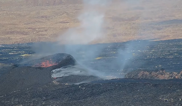
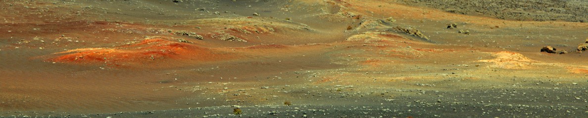
Image webcam de l’éruption le 13 avril 2024
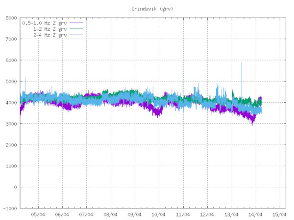
Tremor éruptif le 14 avril 2024 (Source: Icelandic Met Office)
Le soulèvement du sol à Svartsengi semble assez stable et n’a augmenté que très légèrement ces derniers jours.
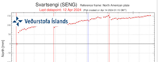
Source: Met Office
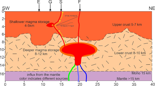
Selon le Met Office, cette situation montre que la plus grande partie du magma s’accumule dans le réservoir situé sous Svartsengi, avec une pression qui provoque le soulèvement du sol. L’éruption se poursuit avec une connexion ouverte entre la zone d’accumulation du magma sous Svartsengi et la chaîne de cratères de Sundhnúkur. Une partie du magma continue de s’écouler vers la surface tandis que le reste s’accumule sous Svartsengi.
L’activité sismique dans le dyke près de Grindavíkreste très faible et se concentre entre Sýlingarfell et Stóra-Skógafell, avec une légère sismicité à l’ouest de Grindavík. L’activité sismique près du Fagradalsfjall, qui persiste depuis un mois, se poursuit et reste localisée à des profondeurs d’environ 6 à 7 km.
A noter qu’un essaim sismique avec un événement de M 3,3 a été enregistré le 13 avril dans la région de Krisuvik, avec son épicentre au niveau du lac Kleifarvatn, à une profondeur de 6 km. Le séisme a été bien ressenti jusque dans la région de Reykjavik et a été suivi de plusieurs répliques.
Des niveaux élevés de SO2 continuent d’être mesurés périodiquement autour du site éruptif et dans les zones habitées de la péninsule de Reykjanes. Les émissions de gaz provenant de l’éruption continueront probablement de générer une pollution sur la péninsule de Reykjanes. Il est conseillé à la population de surveiller la qualité de l’air et de s’informer sur les symptômes liés à la pollution atmosphérique provoquée par l’éruption.
————————————————
![]() In an update released on April 9th, 2024, the Met Office indicated that ground deformation in the Svartsengi area continued to increase, coinciding with a decrease in the intensity of the volcanic eruption, also shown by the volcanic tremor.
In an update released on April 9th, 2024, the Met Office indicated that ground deformation in the Svartsengi area continued to increase, coinciding with a decrease in the intensity of the volcanic eruption, also shown by the volcanic tremor.
Inflation at Svartsengi looks quite stable and has been increasing only very slightly in the past days.
According to the Met Office, this indicates that the majority of the magma flowing into the reservoir beneath Svartsengi is accumulating there, causing an increase in pressure and ground uplift. While the eruption continues, there remains an open connection between the magma accumulation area in Svartsengi and the Sundhnúkur crater row.A portion of the magma continues to flow to the surface whereas the rest accumulates beneath Svartsengi.
Seismic activity in the dike near Grindavík has remained very low and is focused between Sýlingarfell and Stóra-Skógafell, with slight seismicity in western Grindavík. Seismic activity near Fagradalsfjall, which has been persistent for the past month, is ongoing and remains localized at depths of about 6-7 km.
It should be noted that a seismic swarm with an event reaching M 3.3 was recorded on April 13th in the Krisuvik area, with the epicenter at Kleifarvatn lake, at a depth of 6 km. The earthquake was felt well in the capital area andwas followed by several aftershocks.
Periodically high levels of SO2 continue to be measured around the volcano and in settlements on the Reykjanes Peninsula. Gas emissions from the eruption will likely cause pollution on the Reykjanes Peninsula, and residents are advised to monitor air quality and familiarize themselves with symptoms related to air pollution from the eruption.