Sinabung (Ile de Sumatra / Indonésie)

drapeau francais
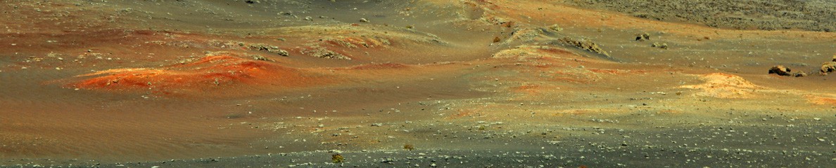
Le Sinabung a connu une nouvelle crise éruptive aujourd’hui mercredi. Des coulées pyroclastiques ont dévalé les pentes du volcan jusqu’à 2,5 kilomètres du cratère. Les villageois sont invités à rester en dehors de la zone de danger qui étend  sur un rayon de 7 km au sud-est du sommet. Aucun blessé n’a été signalé.
Le dôme de lave ne cesse de croître, ce qui le rend très instable. Le Sinabung émet depuis lundi des panaches de gaz et de cendre de plus de 500 mètres de hauteur. Les autorités ont enregistré plus de 50 éruptions dans la matinée de mercredi, mais les villages situés en dehors de la zone évacuée ne sont pas menacés pour le moment.
Source: ABC News.

—————————————-

drapeau anglaisMount Sinabung went through another eruptive crisis today Wednesday. Pyroclastic flows tumbled down the volcano’s slopes up to 2.5 kilometres from the crater. Villagers are urged to stay out of the main danger zone, which stretches 7 kilometres to the southeast of the summit. No injuries were reported.

The lava dome keeps growing, which makes it very unstable. Sinabung has been shooting smoke and ash more than 500 metres into the air since Monday. Authorities counted more than 50 separate eruptions early Wednesday, but said villages outside the evacuated area were not in immediate danger.

Source : ABC News.

Sinabung (Indonésie): L’éruption continue // The eruption continues

drapeau francaisL’éruption du Sinabung continue et le volcan vomit toujours des coulées pyroclastiques. Celle que l’on peut voir sur la photo qui accompagne l’article ci-dessous a été photographiée aujourd’hui 1er avril 2015. En fait, aussi impressionnantes qu’elles puissent être, ces avalanches incandescentes ne changent guère la situation sur le terrain. Le niveau d’alerte du Sinabung est maintenu à 3 (Siaga) et les villages restent évacués dans un rayon de 3 kilomètres autour du volcan. Plus de 18 000 personnes ont dû abandonner leurs maisons en août 2010 quand a débuté l’éruption. Beaucoup de familles sont revenues chez elles et d’autres ont été relogées dans des secteurs moins exposés aux colères du volcan.

http://www.beaumontenterprise.com/news/world/article/Image-of-Asia-Pyroclastic-flows-erupt-from-Mount-6172292.php

 ———————————————–

drapeau anglaisThe eruption of Sinabung continues and the volcano keeps emitting pyroclastic flows. The one on the photo that accompanies the article below was photographed today, April 1st 2015. Actually, as impressive as they may be, these hot avalanches do not much changed the local situation. The alert level of Sinabung is kept at 3 (Siaga) and the villages remain evacuated within 3 kilometres of the volcano. More than 18,000 people had to leave their homes in August 2010 when the volcano started erupting. Many families have returned while others have been resettled outside the danger area.

http://www.beaumontenterprise.com/news/world/article/Image-of-Asia-Pyroclastic-flows-erupt-from-Mount-6172292.php

Sinabung (Indonésie): L’éruption continue

drapeau francaisL’éruption du Sinabung continue, avec son lot de coulées pyroclastiques et de retombées de cendre qui pourrissent la vie des habitants des districts de Tiganderket, Payung et Lau Balang. Samedi matin, de nouvelles coulées ont affecté ces trois districts situés au SO du volcan. Les rues et les maisons ont à nouveau été recouvertes d’une épaisse couche de cendre. Les coulées pyroclastiques ont parcouru jusqu’à 4 km tandis que les panaches de cendre montaient à 3 km de hauteur. Des milliers d’habitants ont dû quitter leurs maisons pour aller se réfugier à Munteh où ils sont restés pendant presque trois heures. Selon les témoins, la crise éruptive a débuté vers 5h30 et s’est accompagnée de forts grondements.

Source : Asia News Network.

En cliquant sur ce lien, vous verrez une superbe et impressionnante photos du Sinabung prise par Martin Rietze:

http://www.dailymail.co.uk/travel/travel_news/article-2897190/Lightning-storm-engulfs-ash-cloud-erupting-Sinabung-volcano-Indonesia.html

 —————————————-

drapeau anglaisThe eruption of Mount Sinabung continues. The frequent pyroclastic flows and the ensuing ashfall disturb activities in the districts of Tiganderket, Payung and Lau Balang. On Saturday morning, pyroclastic flows hit the three districts located southwest of the volcano, completely covering the area with thick layers of volcanic ash. The flows travelled as far as 4 km while the volcanic ash reached up to 3 km into the sky. Thousands of residents were forced to flee their homes and go as far as Munteh where they stayed almost three hours. According to witnesses, the eruption occurred at 5:30 am and was accompanied by powerful thundering sounds.
Source : Asia News Network.

By clicking on this link, you will see a great and impressive gallery of photos taken by Martin Rietze:

http://www.dailymail.co.uk/travel/travel_news/article-2897190/Lightning-storm-engulfs-ash-cloud-erupting-Sinabung-volcano-Indonesia.html

Sinabung-novembre

Le Sinabung vu par la webcam.

Sinabung (Indonésie)

drapeau francaisLe Sinabung reste très actif avec des panaches de cendres et des coulées pyroclastiques. En outre, il existe un risque élevé de lahars pendant les périodes de fortes pluies. La plupart du temps, les panaches de cendre atteignent une altitude de 5 km avant de s’étirer sur 15 à 40 km. Les écoulements pyroclastiques peuvent aller jusqu’à plus de 3 km du cratère.
3284 personnes appartenant à 1018 familles restent dans des abris. Le président indonésien a ordonné aux autorités d’accélérer le relogement des personnes déplacées lors d’une visite au centre d’évacuation du district de Karo, le 29 octobre dernier.

Le Sinabung est entré en éruption en septembre 2013 et en février 2014 une éruption a tué 17 personnes tandis que plus de 33 000 habitants étaient obligés d’abandonner leurs maisons.
Source: GVN et The Jakarta Globe.

 ———————————————————

drapeau anglaisSinabung is still quite active with ash plumes and pyroclastic flows. Besides, there is a high risk of lahars during heavy rain periods. Most of the time, ash plumes reach altitudes of 5 km a.s.l. and drift over 15 – 40 km. Pyroclastic flows may travel more than 3 km from the crater.
3,284 people from 1,018 families remain in evacuation shelters. The Indonesian President ordered authorities to speed up the relocation of displaced residents during a visit at the evacuation center in Karo district on October 29th.

Sinabung began erupting on September 2013 and in February 2014 an eruption killed about 17 people while more than 33,000 residents were forced to flee their homes.

Source: GVN and The Jakarta Globe.