
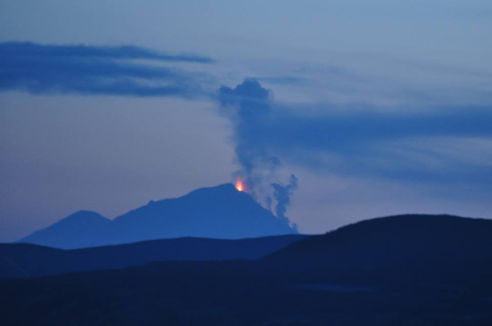
![]() Dans son dernier rapport, l’AVO indique que l’éruption du Pavlof continue. « Des fontaines de lave au sommet ont été observées et photographiées et un panache de cendre, de vapeur et de gaz s’étire sur une distance de 50 à 100 km, à une altitude d’environ 6 km. Les images satellites montrent en permanence des températures de surface élevées au sommet et sur le flanc nord-ouest. L’activité sismique reste intense, avec un tremor presque continu. »
Dans son dernier rapport, l’AVO indique que l’éruption du Pavlof continue. « Des fontaines de lave au sommet ont été observées et photographiées et un panache de cendre, de vapeur et de gaz s’étire sur une distance de 50 à 100 km, à une altitude d’environ 6 km. Les images satellites montrent en permanence des températures de surface élevées au sommet et sur le flanc nord-ouest. L’activité sismique reste intense, avec un tremor presque continu. »
Un bon nombre de photos du Pavlof peuvent maintenant être vues sur Internet. Voici deux d’entre elles :
http://www.alaskapublic.org/wp-content/uploads/2013/05/Pavlof_GinaStafford.jpg
https://twitter.com/Q13FOX/status/335246617710059520/photo/1
Sans oublier une image satellite de la NASA en date du 16 mai 2013:
http://earthobservatory.nasa.gov/IOTD/view.php?id=81190
 In its latest report, AVO indicates that Pavlof continues to erupt. “Lava fountaining at the summit has been observed and photographed, and an ash, steam, and gas cloud generated by the activity extends downwind from the volcano for 50 to 100 km at an altitude of about 6 km a.s.l. Satellite images show persistent elevated surface temperatures at the summit and on the northwest flank. Seismic activity remains elevated with nearly continuous tremor.”
Quite a good number of photos of Pavlof can now be seen on the Internet. Here are two of them:
http://www.alaskapublic.org/wp-content/uploads/2013/05/Pavlof_GinaStafford.jpg
https://twitter.com/Q13FOX/status/335246617710059520/photo/1
Without forgetting a NASA satellite image (May 16th 2013):
