
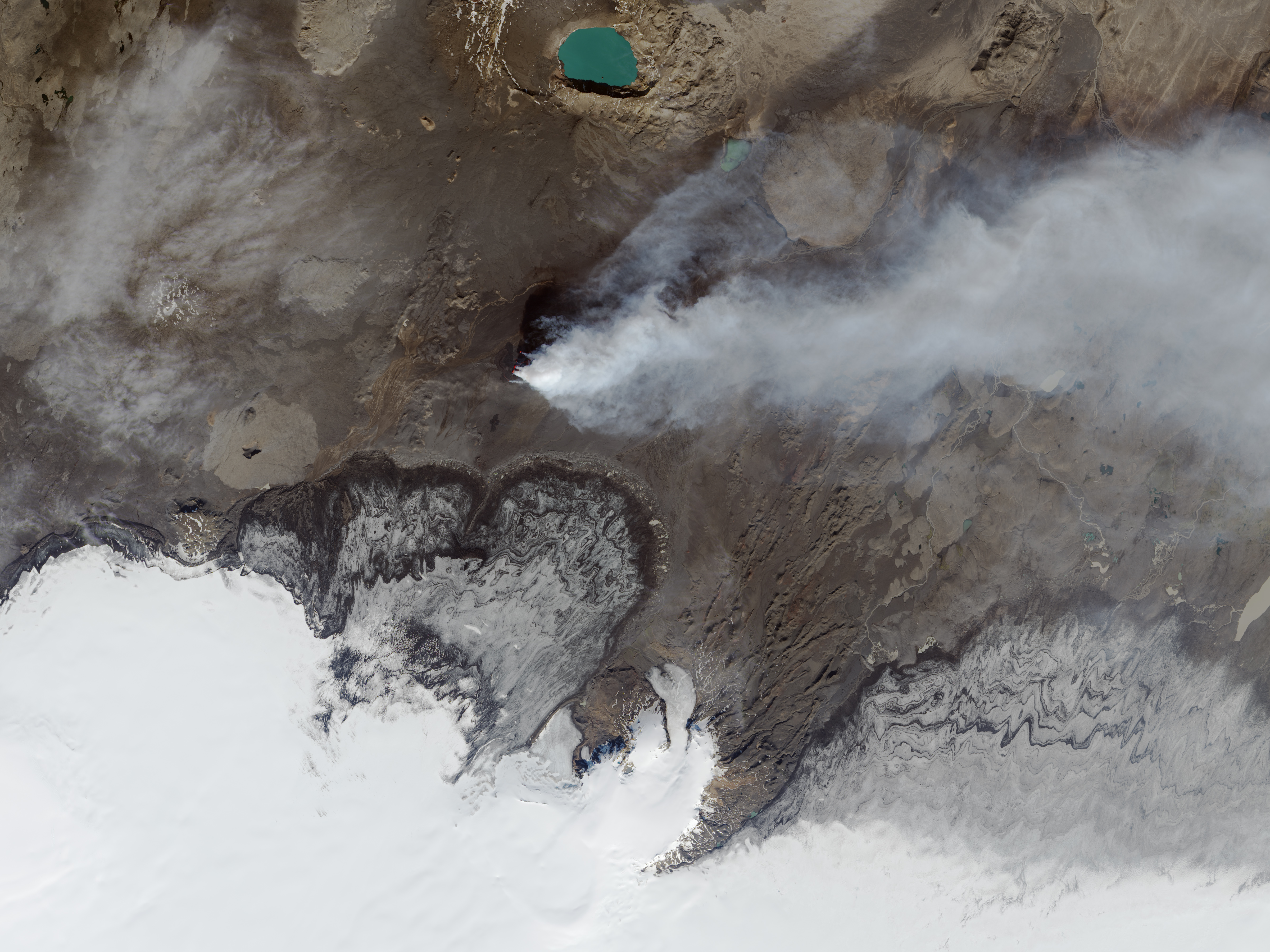
![]() Le 6 septembre 2014, le système d’imagerie du satellite Landsat 8 a pris une photo de l’éruption en cours dans l’Holuhraun. Les couleurs ne sont pas réelles car elles associent la lumière infrarouge, proche infrarouge, et verte (bandes OLI 6-5-3) à ondes courtes. Ainsi, la glace et le panache de vapeur et de dioxyde de soufre apparaissent en cyan et bleu clair, tandis que l’eau revêt une couleur bleu marine. Le sol nu ou rocheux autour du champ de lave de l’Holuhraun prend des nuances de vert ou de brun dans cette combinaison de bandes. La lave en train d’être émise est orange vif et rouge..
Le 6 septembre 2014, le système d’imagerie du satellite Landsat 8 a pris une photo de l’éruption en cours dans l’Holuhraun. Les couleurs ne sont pas réelles car elles associent la lumière infrarouge, proche infrarouge, et verte (bandes OLI 6-5-3) à ondes courtes. Ainsi, la glace et le panache de vapeur et de dioxyde de soufre apparaissent en cyan et bleu clair, tandis que l’eau revêt une couleur bleu marine. Le sol nu ou rocheux autour du champ de lave de l’Holuhraun prend des nuances de vert ou de brun dans cette combinaison de bandes. La lave en train d’être émise est orange vif et rouge..
http://www.earthobservatory.nasa.gov/IOTD/view.php?id=84316
Vous pourrez télécharger cette image pour voir la même zone avec les couleurs naturelles:
http://eoimages.gsfc.nasa.gov/images/imagerecords/84000/84316/holuhraun_oli_2014249_lrg.jpg
—————————————-
![]() On September 6th, 2014, the Land Imager on Landsat 8 captured this view of the ongoing eruption in Holuhraun. The false-color images combine shortwave infrared, near infrared, and green light (OLI bands 6-5-3). Ice and the plume of steam and sulfur dioxide appear cyan and bright blue, while liquid water is navy blue. Bare or rocky ground around the Holuhraun lava field appears in shades of green or brown in this band combination. Fresh lava is bright orange and red.
On September 6th, 2014, the Land Imager on Landsat 8 captured this view of the ongoing eruption in Holuhraun. The false-color images combine shortwave infrared, near infrared, and green light (OLI bands 6-5-3). Ice and the plume of steam and sulfur dioxide appear cyan and bright blue, while liquid water is navy blue. Bare or rocky ground around the Holuhraun lava field appears in shades of green or brown in this band combination. Fresh lava is bright orange and red.
http://www.earthobservatory.nasa.gov/IOTD/view.php?id=84316
You can download this large image to see the same area in natural colours:
http://eoimages.gsfc.nasa.gov/images/imagerecords/84000/84316/holuhraun_oli_2014249_lrg.jpg


