
 La partie sud-ouest de l’Alaska a été secouée par un violent séisme de magnitude M 7.1 aux premières heures du dimanche 24 janvier 2016 (voir ma note du 25 janvier), avec la destruction de quatre maisons sur la péninsule de Kenai et un mouvement de panique dans toute la région. Le séisme s’est produit à 1h30 (heure locale) sur la rive ouest de Cook Inlet, à environ 105 km à l’ouest de Homer et à environ 260 km au sud-ouest d’Anchorage, à une profondeur de 120 km. Il a duré une trentaine de secondes et a été ressenti jusqu’à Juneau et Fairbanks.
Une vidéo de l’USGS montre de manière amplifiée la réaction, et surtout la résistance à ce séisme, du Robert B.Atwood Building, un édifice célèbre du centre-ville d’Anchorage.
https://youtu.be/Nt0m5JWa62w
La vidéo propose une transposition informatique des mouvements de cet immeuble situé à l’angle de West Seventh Avenue et F Street. Ils sont amplifiés 300 fois à des fins d’étude. Le but est de montrer les contraintes que doit supporter un bâtiment, tant au niveau de la translation – nord, sud, est, ouest – que de la torsion. Bien que les mouvements soient amplifiés dans la vidéo, la durée est conforme à celle enregistrée par les sismographes pendant l’événement.
Les sismologues étudient également les mouvements de deux autres bâtiments d’Anchorage : l’hôtel Hilton et le Frontier Building à l’angle de 36th Avenue et A Street. Aucun d’entre eux n’a été endommagé pendant le séisme.
Sources: USGS / ADN.
————————————–
 Southcentral Alaska was rocked by a strong and prolonged M 7.1 earthquake early Sunday January 24th 2016 (see my note of January 26th), destroying four homes on the Kenai Peninsula and causing panic throughout the region. The quake struck at 1:30 a.m (local time) on the west side of Cook Inlet, about 105 km west of Homer and about 260 km southwest of Anchorage, at a depth of 120 km. It was felt from Juneau to Fairbanks.
A video from the U.S. Geological Survey offers an amplified look at how one of downtown Anchorage’s landmark structures weathered the event.
The video depicts computer-generated movements of the Atwood Building at West Seventh Avenue and F Street. They are magnified 300 times for study purposes. The aim is to show the actual motions that a building can have, which is translational — north, south, east, west — and then torsional. Although the motion in the video is magnified, how long the Atwood moves in the clip is unchanged from the day of the quake.
The seismologists are also examining the movements of two other Anchorage buildings during the quake, including the Anchorage Hilton and the Frontier Building at 36th Avenue and A Street. None of them were damaged during the quake.
Sources : USGS / ADN.
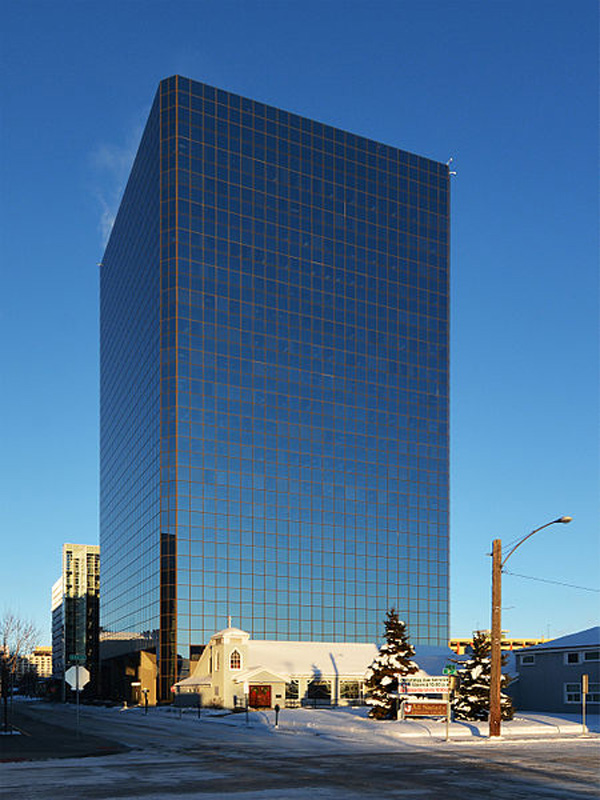
Robert B. Atwood Building dans le centre-ville d’Anchorage (Crédit photo: Wikipedia)
