 Les volcans chiliens sont en grande forme! Après le Chaiten en 2008 et le Puyehue en juin dernier, c’est autour de l’Hudson de montrer de sérieux signes de réveil. Le volcan, qui se trouve à 1600 km au sud de Santiago, est entré pour la dernière fois en éruption en août 1991. Une partie du glacier qui le surmonte a alors fondu en provoquant des lahars. Les fermes de la région ont connu de gros dégâts et on estime que 1,5 millions de moutons ont péri pendant l’éruption.
L’Hudson connaît un regain d’activité sismique depuis mardi soir et de la vapeur sous pression s’échappe du volcan. Le niveau d’alerte est passé au Rouge. Une centaine d’habitants ont été évacués par précaution dans un rayon de 40 km autour du volcan.
 Chilean volcanoes are in great shape ! After Chaiten in 2008 and Puyehue in last June, Mount Hudson is showing signs of awakening. The volcano, which lies 1,600 km south of Santiago, last erupted in August 1991. The eruption melted part of the glacier above it, causing lahars. The farms in the area were seriously damaged and an estimates 1.5 million sheep died.
Seismic activity at Mount Hudson has been increasing since Tuesday night and jets of steam are coming out of the volcano. The alert level has been raised to Red and 100 residents or so have been evacuated as a precaution in a radius of 40 km around the volcano.
Le Cerro Hudson (Avec l’aimable autorisation de l’USGS)
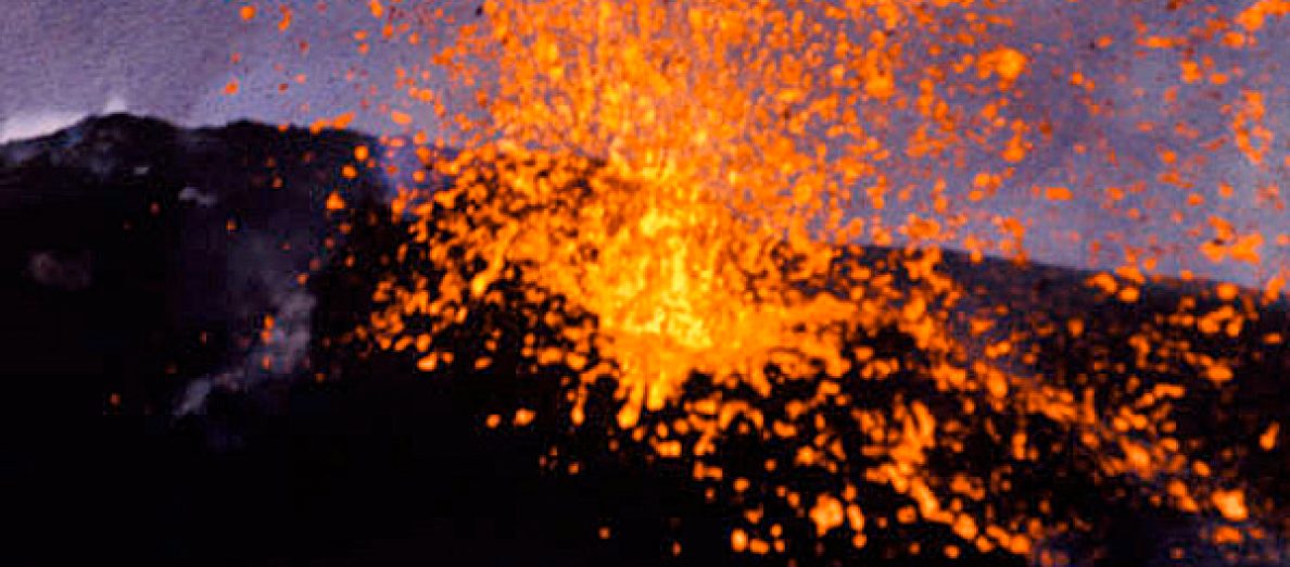
 Voici une petite vidéo montrant la dernière activité du Cerro Hudson cette semaine. Il faut espérer que le Père Noël apportera un pied au vidéaste !
 Here a short video showing Cerro Hudson’s latest activity. Let’s hope Father Christmas will bring the film-maker a tripod !
 En cliquant sur le lien ci-dessous, vous découvrirez – j’oserais dire « enfin ! » – une image du cône sous-marin d’El Hierro obtenue par les scientifiques embarqués à bord du navire « Ramón Margalef ». Le sommet se trouve à 230 mètres de profondeur alors que le fond de l’océan s’étend 70 mètres plus bas.
 By clicking on the link here below, you’ll discover – at last ! – a picture of the submarine cone of El Hierro volcano. It was released by scientists on board « Ramón Margalef ». The summit is located 230 metres below sea level and the bottom of the ocean 70 metres deeper.